You are here: Home > Network List > TA - USArray Transportable Network (new EarthScope stations) Stations List
> Station Q36A Arnold C. Orvedal, Lecompton, KS, USA > Earthquake Result Viewer
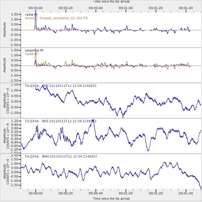
Q36A Arnold C. Orvedal, Lecompton, KS, USA - Earthquake Result Viewer
*The percent match for this event was below the threshold and hence no stack was calculated.
| Earthquake location: |
Near East Coast Of Honshu, Japan |
| Earthquake latitude/longitude: |
37.7/141.5 |
| Earthquake time(UTC): |
2011/03/11 (070) 11:00:52 GMT |
| Earthquake Depth: |
42 km |
| Earthquake Magnitude: |
5.6 MB |
| Earthquake Catalog/Contributor: |
WHDF/NEIC |
|
| Network: |
TA USArray Transportable Network (new EarthScope stations) |
| Station: |
Q36A Arnold C. Orvedal, Lecompton, KS, USA |
| Lat/Lon: |
38.96 N/95.46 W |
| Elevation: |
306 m |
|
| Distance: |
87.4 deg |
| Az: |
40.858 deg |
| Baz: |
318.299 deg |
| Ray Param: |
$rayparam |
*The percent match for this event was below the threshold and hence was not used in the summary stack. |
|
| Radial Match: |
56.155693 % |
| Radial Bump: |
215 |
| Transverse Match: |
67.80501 % |
| Transverse Bump: |
371 |
| SOD ConfigId: |
356183 |
| Insert Time: |
2011-08-14 16:11:08.404 +0000 |
| GWidth: |
2.5 |
| Max Bumps: |
400 |
| Tol: |
0.001 |
|
Signal To Noise
| Channel | StoN | STA | LTA |
| TA:Q36A: :BHZ:20110311T11:13:04.224993Z | 0.38536867 | 4.4411019E-7 | 1.1524294E-6 |
| TA:Q36A: :BHN:20110311T11:13:04.224993Z | 1.0289195 | 1.8402069E-6 | 1.788485E-6 |
| TA:Q36A: :BHE:20110311T11:13:04.224993Z | 2.3564117 | 8.935221E-7 | 3.791876E-7 |
| Arrivals |
| Ps | |
| PpPs | |
| PsPs/PpSs | |


