You are here: Home > Network List > UU - University of Utah Regional Network Stations List
> Station CCUT Cedar City, UT, USA > Earthquake Result Viewer
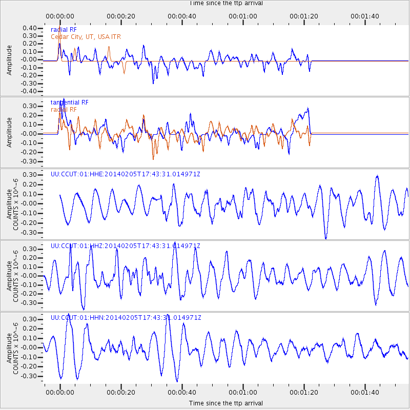
CCUT Cedar City, UT, USA - Earthquake Result Viewer
*The percent match for this event was below the threshold and hence no stack was calculated.
| Earthquake location: |
Near East Coast Of Honshu, Japan |
| Earthquake latitude/longitude: |
38.7/142.4 |
| Earthquake time(UTC): |
2014/02/05 (036) 17:32:13 GMT |
| Earthquake Depth: |
46 km |
| Earthquake Magnitude: |
5.3 MW |
| Earthquake Catalog/Contributor: |
ISC/ISC |
|
| Network: |
UU University of Utah Regional Network |
| Station: |
CCUT Cedar City, UT, USA |
| Lat/Lon: |
37.55 N/113.36 W |
| Elevation: |
2127 m |
|
| Distance: |
77.0 deg |
| Az: |
52.22 deg |
| Baz: |
308.908 deg |
| Ray Param: |
$rayparam |
*The percent match for this event was below the threshold and hence was not used in the summary stack. |
|
| Radial Match: |
47.934658 % |
| Radial Bump: |
364 |
| Transverse Match: |
57.026127 % |
| Transverse Bump: |
400 |
| SOD ConfigId: |
3390531 |
| Insert Time: |
2019-04-10 06:06:15.882 +0000 |
| GWidth: |
2.5 |
| Max Bumps: |
400 |
| Tol: |
0.001 |
|
Signal To Noise
| Channel | StoN | STA | LTA |
| UU:CCUT:01:HHZ:20140205T17:43:31.014971Z | 1.5229646 | 1.429908E-7 | 9.3889774E-8 |
| UU:CCUT:01:HHN:20140205T17:43:31.014971Z | 2.2788792 | 2.340912E-7 | 1.02722076E-7 |
| UU:CCUT:01:HHE:20140205T17:43:31.014971Z | 0.7417373 | 7.3622516E-8 | 9.925686E-8 |
| Arrivals |
| Ps | |
| PpPs | |
| PsPs/PpSs | |


