You are here: Home > Network List > TA - USArray Transportable Network (new EarthScope stations) Stations List
> Station I35A Creekview Farms, Bingham Lake, MN, USA > Earthquake Result Viewer
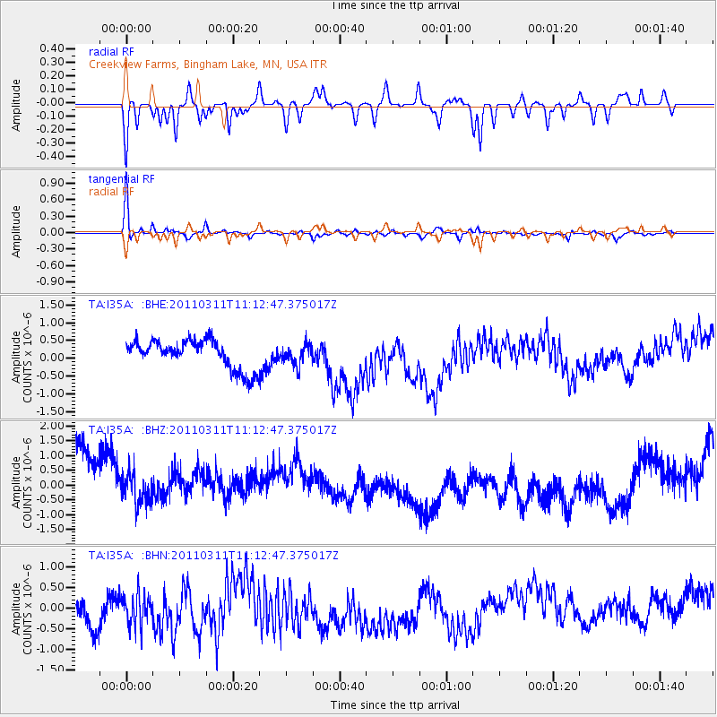
I35A Creekview Farms, Bingham Lake, MN, USA - Earthquake Result Viewer
*The percent match for this event was below the threshold and hence no stack was calculated.
| Earthquake location: |
Near East Coast Of Honshu, Japan |
| Earthquake latitude/longitude: |
37.7/141.5 |
| Earthquake time(UTC): |
2011/03/11 (070) 11:00:52 GMT |
| Earthquake Depth: |
42 km |
| Earthquake Magnitude: |
5.6 MB |
| Earthquake Catalog/Contributor: |
WHDF/NEIC |
|
| Network: |
TA USArray Transportable Network (new EarthScope stations) |
| Station: |
I35A Creekview Farms, Bingham Lake, MN, USA |
| Lat/Lon: |
43.86 N/94.98 W |
| Elevation: |
428 m |
|
| Distance: |
84.0 deg |
| Az: |
37.328 deg |
| Baz: |
318.351 deg |
| Ray Param: |
$rayparam |
*The percent match for this event was below the threshold and hence was not used in the summary stack. |
|
| Radial Match: |
28.457952 % |
| Radial Bump: |
279 |
| Transverse Match: |
72.25319 % |
| Transverse Bump: |
260 |
| SOD ConfigId: |
356183 |
| Insert Time: |
2011-08-14 16:17:06.024 +0000 |
| GWidth: |
2.5 |
| Max Bumps: |
400 |
| Tol: |
0.001 |
|
Signal To Noise
| Channel | StoN | STA | LTA |
| TA:I35A: :BHZ:20110311T11:12:47.375017Z | 0.39478865 | 7.769187E-7 | 1.9679358E-6 |
| TA:I35A: :BHN:20110311T11:12:47.375017Z | 0.8427159 | 9.600301E-7 | 1.1392096E-6 |
| TA:I35A: :BHE:20110311T11:12:47.375017Z | 0.67776966 | 2.7900631E-7 | 4.1165362E-7 |
| Arrivals |
| Ps | |
| PpPs | |
| PsPs/PpSs | |


