You are here: Home > Network List > TA - USArray Transportable Network (new EarthScope stations) Stations List
> Station E36A McGregor, MN, USA > Earthquake Result Viewer
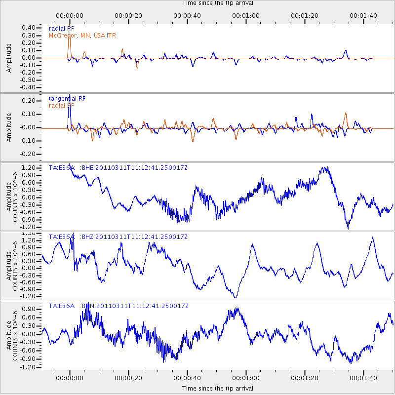
E36A McGregor, MN, USA - Earthquake Result Viewer
*The percent match for this event was below the threshold and hence no stack was calculated.
| Earthquake location: |
Near East Coast Of Honshu, Japan |
| Earthquake latitude/longitude: |
37.7/141.5 |
| Earthquake time(UTC): |
2011/03/11 (070) 11:00:52 GMT |
| Earthquake Depth: |
42 km |
| Earthquake Magnitude: |
5.6 MB |
| Earthquake Catalog/Contributor: |
WHDF/NEIC |
|
| Network: |
TA USArray Transportable Network (new EarthScope stations) |
| Station: |
E36A McGregor, MN, USA |
| Lat/Lon: |
46.52 N/93.26 W |
| Elevation: |
393 m |
|
| Distance: |
82.8 deg |
| Az: |
34.639 deg |
| Baz: |
319.265 deg |
| Ray Param: |
$rayparam |
*The percent match for this event was below the threshold and hence was not used in the summary stack. |
|
| Radial Match: |
13.300647 % |
| Radial Bump: |
195 |
| Transverse Match: |
78.83467 % |
| Transverse Bump: |
350 |
| SOD ConfigId: |
356183 |
| Insert Time: |
2011-08-14 16:33:52.095 +0000 |
| GWidth: |
2.5 |
| Max Bumps: |
400 |
| Tol: |
0.001 |
|
Signal To Noise
| Channel | StoN | STA | LTA |
| TA:E36A: :BHZ:20110311T11:12:41.250017Z | 1.0705475 | 2.6620314E-6 | 2.4866076E-6 |
| TA:E36A: :BHN:20110311T11:12:41.250017Z | 0.8499265 | 3.6256685E-7 | 4.2658615E-7 |
| TA:E36A: :BHE:20110311T11:12:41.250017Z | 1.1200954 | 5.862607E-7 | 5.2340243E-7 |
| Arrivals |
| Ps | |
| PpPs | |
| PsPs/PpSs | |


