You are here: Home > Network List > TA - USArray Transportable Network (new EarthScope stations) Stations List
> Station P37A Lathrop, MO, USA > Earthquake Result Viewer
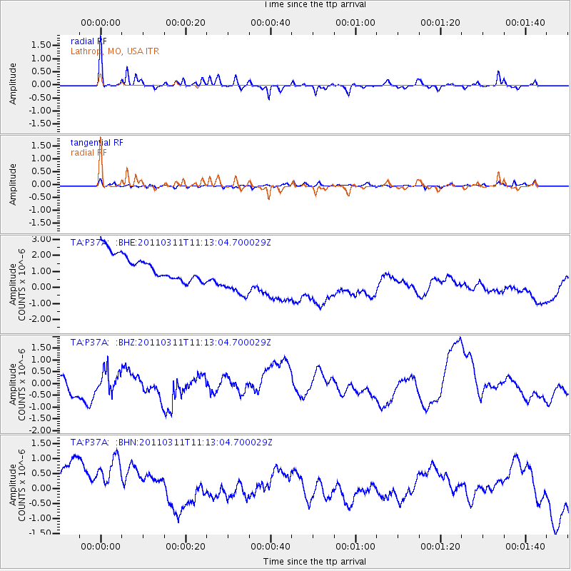
P37A Lathrop, MO, USA - Earthquake Result Viewer
*The percent match for this event was below the threshold and hence no stack was calculated.
| Earthquake location: |
Near East Coast Of Honshu, Japan |
| Earthquake latitude/longitude: |
37.7/141.5 |
| Earthquake time(UTC): |
2011/03/11 (070) 11:00:52 GMT |
| Earthquake Depth: |
42 km |
| Earthquake Magnitude: |
5.6 MB |
| Earthquake Catalog/Contributor: |
WHDF/NEIC |
|
| Network: |
TA USArray Transportable Network (new EarthScope stations) |
| Station: |
P37A Lathrop, MO, USA |
| Lat/Lon: |
39.59 N/94.35 W |
| Elevation: |
300 m |
|
| Distance: |
87.5 deg |
| Az: |
39.796 deg |
| Baz: |
318.953 deg |
| Ray Param: |
$rayparam |
*The percent match for this event was below the threshold and hence was not used in the summary stack. |
|
| Radial Match: |
53.27246 % |
| Radial Bump: |
226 |
| Transverse Match: |
56.059013 % |
| Transverse Bump: |
337 |
| SOD ConfigId: |
356183 |
| Insert Time: |
2011-08-14 16:37:59.212 +0000 |
| GWidth: |
2.5 |
| Max Bumps: |
400 |
| Tol: |
0.001 |
|
Signal To Noise
| Channel | StoN | STA | LTA |
| TA:P37A: :BHZ:20110311T11:13:04.700029Z | 0.35916772 | 4.418157E-7 | 1.2301098E-6 |
| TA:P37A: :BHN:20110311T11:13:04.700029Z | 1.0552202 | 2.3121052E-6 | 2.1911114E-6 |
| TA:P37A: :BHE:20110311T11:13:04.700029Z | 1.9271986 | 1.5260084E-6 | 7.918273E-7 |
| Arrivals |
| Ps | |
| PpPs | |
| PsPs/PpSs | |


