You are here: Home > Network List > US - United States National Seismic Network Stations List
> Station DGMT Dagmar, Montana, USA > Earthquake Result Viewer
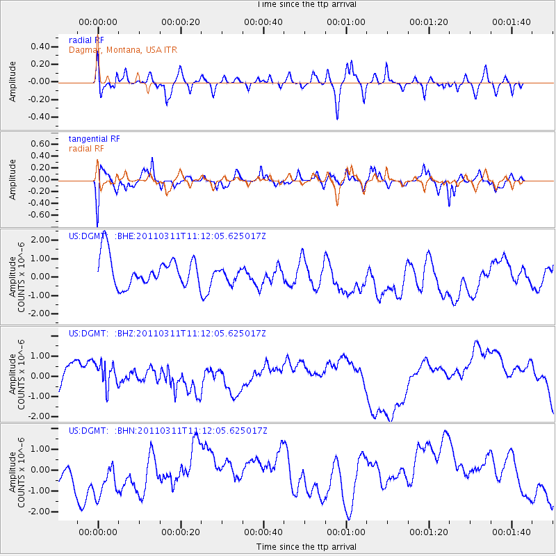
DGMT Dagmar, Montana, USA - Earthquake Result Viewer
*The percent match for this event was below the threshold and hence no stack was calculated.
| Earthquake location: |
Near East Coast Of Honshu, Japan |
| Earthquake latitude/longitude: |
37.7/141.5 |
| Earthquake time(UTC): |
2011/03/11 (070) 11:00:52 GMT |
| Earthquake Depth: |
42 km |
| Earthquake Magnitude: |
5.6 MB |
| Earthquake Catalog/Contributor: |
WHDF/NEIC |
|
| Network: |
US United States National Seismic Network |
| Station: |
DGMT Dagmar, Montana, USA |
| Lat/Lon: |
48.47 N/104.20 W |
| Elevation: |
0.0 m |
|
| Distance: |
76.2 deg |
| Az: |
38.638 deg |
| Baz: |
311.94 deg |
| Ray Param: |
$rayparam |
*The percent match for this event was below the threshold and hence was not used in the summary stack. |
|
| Radial Match: |
53.386017 % |
| Radial Bump: |
400 |
| Transverse Match: |
52.890163 % |
| Transverse Bump: |
400 |
| SOD ConfigId: |
356183 |
| Insert Time: |
2011-08-14 17:00:04.219 +0000 |
| GWidth: |
2.5 |
| Max Bumps: |
400 |
| Tol: |
0.001 |
|
Signal To Noise
| Channel | StoN | STA | LTA |
| US:DGMT: :BHZ:20110311T11:12:05.625017Z | 1.4773512 | 8.662345E-7 | 5.8634294E-7 |
| US:DGMT: :BHN:20110311T11:12:05.625017Z | 1.4138455 | 1.464389E-6 | 1.0357489E-6 |
| US:DGMT: :BHE:20110311T11:12:05.625017Z | 0.5020726 | 4.033906E-7 | 8.0345075E-7 |
| Arrivals |
| Ps | |
| PpPs | |
| PsPs/PpSs | |


