You are here: Home > Network List > UW - Pacific Northwest Regional Seismic Network Stations List
> Station MRBL Marblemount, WA, USA > Earthquake Result Viewer
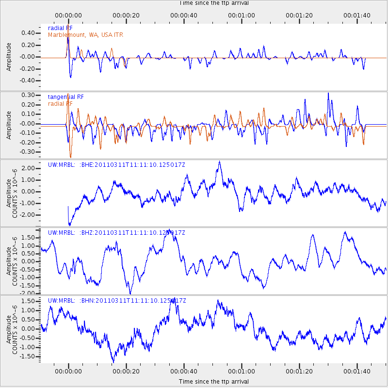
MRBL Marblemount, WA, USA - Earthquake Result Viewer
*The percent match for this event was below the threshold and hence no stack was calculated.
| Earthquake location: |
Near East Coast Of Honshu, Japan |
| Earthquake latitude/longitude: |
37.7/141.5 |
| Earthquake time(UTC): |
2011/03/11 (070) 11:00:52 GMT |
| Earthquake Depth: |
42 km |
| Earthquake Magnitude: |
5.6 MB |
| Earthquake Catalog/Contributor: |
WHDF/NEIC |
|
| Network: |
UW Pacific Northwest Regional Seismic Network |
| Station: |
MRBL Marblemount, WA, USA |
| Lat/Lon: |
48.52 N/121.48 W |
| Elevation: |
75 m |
|
| Distance: |
67.0 deg |
| Az: |
45.8 deg |
| Baz: |
301.256 deg |
| Ray Param: |
$rayparam |
*The percent match for this event was below the threshold and hence was not used in the summary stack. |
|
| Radial Match: |
34.32859 % |
| Radial Bump: |
373 |
| Transverse Match: |
53.582 % |
| Transverse Bump: |
343 |
| SOD ConfigId: |
356183 |
| Insert Time: |
2011-08-14 17:04:41.606 +0000 |
| GWidth: |
2.5 |
| Max Bumps: |
400 |
| Tol: |
0.001 |
|
Signal To Noise
| Channel | StoN | STA | LTA |
| UW:MRBL: :BHZ:20110311T11:11:10.125017Z | 0.60297847 | 4.817067E-7 | 7.988788E-7 |
| UW:MRBL: :BHN:20110311T11:11:10.125017Z | 0.9733405 | 1.2325729E-6 | 1.2663328E-6 |
| UW:MRBL: :BHE:20110311T11:11:10.125017Z | 0.3399961 | 2.877336E-7 | 8.4628493E-7 |
| Arrivals |
| Ps | |
| PpPs | |
| PsPs/PpSs | |


