You are here: Home > Network List > IU - Global Seismograph Network (GSN - IRIS/USGS) Stations List
> Station FURI Mt. Furi, Ethiopia > Earthquake Result Viewer
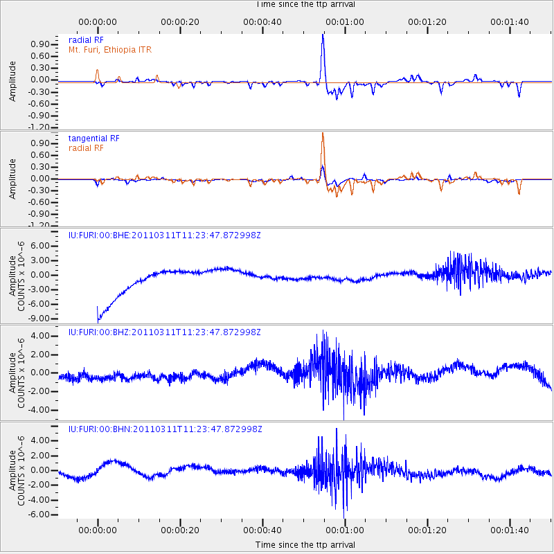
FURI Mt. Furi, Ethiopia - Earthquake Result Viewer
*The percent match for this event was below the threshold and hence no stack was calculated.
| Earthquake location: |
Near East Coast Of Honshu, Japan |
| Earthquake latitude/longitude: |
35.5/141.8 |
| Earthquake time(UTC): |
2011/03/11 (070) 11:10:58 GMT |
| Earthquake Depth: |
35 km |
| Earthquake Magnitude: |
5.5 MB |
| Earthquake Catalog/Contributor: |
WHDF/NEIC |
|
| Network: |
IU Global Seismograph Network (GSN - IRIS/USGS) |
| Station: |
FURI Mt. Furi, Ethiopia |
| Lat/Lon: |
8.90 N/38.68 E |
| Elevation: |
2570 m |
|
| Distance: |
95.4 deg |
| Az: |
284.87 deg |
| Baz: |
52.916 deg |
| Ray Param: |
$rayparam |
*The percent match for this event was below the threshold and hence was not used in the summary stack. |
|
| Radial Match: |
70.078255 % |
| Radial Bump: |
285 |
| Transverse Match: |
40.021336 % |
| Transverse Bump: |
283 |
| SOD ConfigId: |
356183 |
| Insert Time: |
2011-08-14 17:56:20.576 +0000 |
| GWidth: |
2.5 |
| Max Bumps: |
400 |
| Tol: |
0.001 |
|
Signal To Noise
| Channel | StoN | STA | LTA |
| IU:FURI:00:BHZ:20110311T11:23:47.872998Z | 1.3826785 | 9.561819E-7 | 6.915432E-7 |
| IU:FURI:00:BHN:20110311T11:23:47.872998Z | 1.5081933 | 2.1966146E-6 | 1.4564544E-6 |
| IU:FURI:00:BHE:20110311T11:23:47.872998Z | 0.99031854 | 2.9681098E-6 | 2.9971263E-6 |
| Arrivals |
| Ps | |
| PpPs | |
| PsPs/PpSs | |


