You are here: Home > Network List > AZ - ANZA Regional Network Stations List
> Station LVA2 AZ.LVA2 > Earthquake Result Viewer
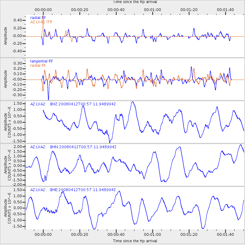
LVA2 AZ.LVA2 - Earthquake Result Viewer
*The percent match for this event was below the threshold and hence no stack was calculated.
| Earthquake location: |
Kuril Islands |
| Earthquake latitude/longitude: |
43.9/147.5 |
| Earthquake time(UTC): |
2008/04/12 (103) 00:46:28 GMT |
| Earthquake Depth: |
64 km |
| Earthquake Magnitude: |
5.7 MB |
| Earthquake Catalog/Contributor: |
WHDF/NEIC |
|
| Network: |
AZ ANZA Regional Network |
| Station: |
LVA2 AZ.LVA2 |
| Lat/Lon: |
33.35 N/116.56 W |
| Elevation: |
1435 m |
|
| Distance: |
71.6 deg |
| Az: |
61.315 deg |
| Baz: |
310.719 deg |
| Ray Param: |
$rayparam |
*The percent match for this event was below the threshold and hence was not used in the summary stack. |
|
| Radial Match: |
59.840553 % |
| Radial Bump: |
400 |
| Transverse Match: |
52.674328 % |
| Transverse Bump: |
400 |
| SOD ConfigId: |
2504 |
| Insert Time: |
2010-02-26 19:54:33.126 +0000 |
| GWidth: |
2.5 |
| Max Bumps: |
400 |
| Tol: |
0.001 |
|
Signal To Noise
| Channel | StoN | STA | LTA |
| AZ:LVA2: :BHN:20080412T00:57:11.948994Z | 2.6741774 | 1.123299E-6 | 4.2005402E-7 |
| AZ:LVA2: :BHE:20080412T00:57:11.948994Z | 0.40363958 | 2.0233287E-7 | 5.0127113E-7 |
| AZ:LVA2: :BHZ:20080412T00:57:11.948994Z | 1.7657032 | 8.37786E-7 | 4.7447725E-7 |
| Arrivals |
| Ps | |
| PpPs | |
| PsPs/PpSs | |


