You are here: Home > Network List > TA - USArray Transportable Network (new EarthScope stations) Stations List
> Station R11A Troy Canyon, Currant, NV, USA > Earthquake Result Viewer
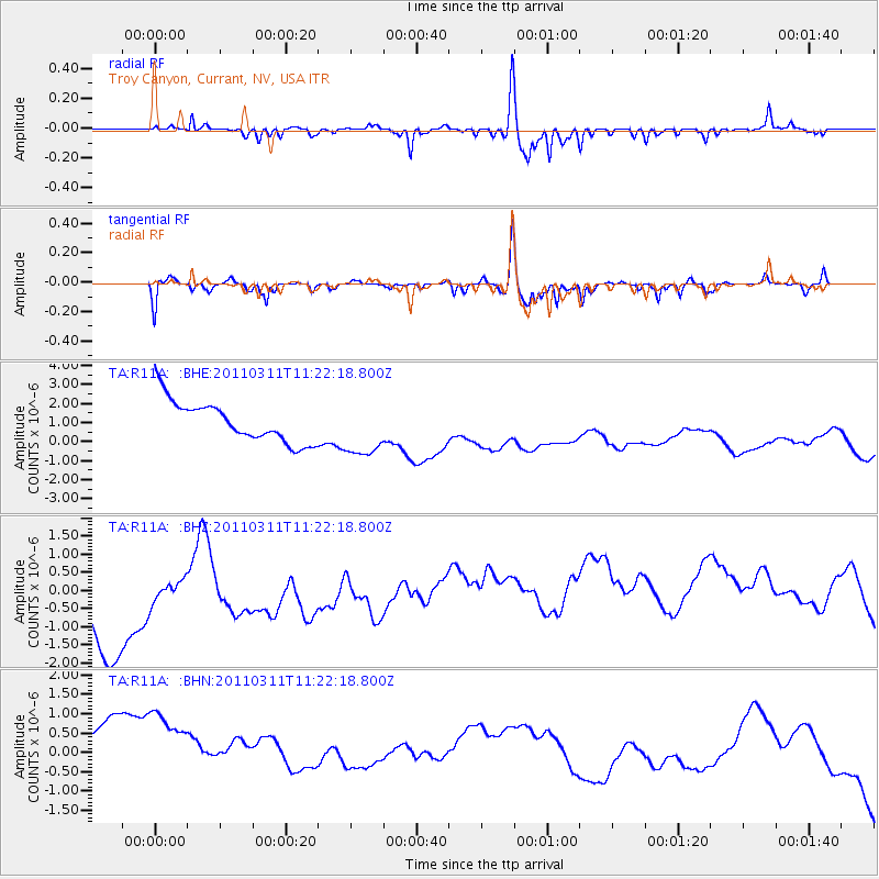
R11A Troy Canyon, Currant, NV, USA - Earthquake Result Viewer
*The percent match for this event was below the threshold and hence no stack was calculated.
| Earthquake location: |
Near East Coast Of Honshu, Japan |
| Earthquake latitude/longitude: |
35.5/141.8 |
| Earthquake time(UTC): |
2011/03/11 (070) 11:10:58 GMT |
| Earthquake Depth: |
35 km |
| Earthquake Magnitude: |
5.5 MB |
| Earthquake Catalog/Contributor: |
WHDF/NEIC |
|
| Network: |
TA USArray Transportable Network (new EarthScope stations) |
| Station: |
R11A Troy Canyon, Currant, NV, USA |
| Lat/Lon: |
38.35 N/115.59 W |
| Elevation: |
1756 m |
|
| Distance: |
77.4 deg |
| Az: |
51.842 deg |
| Baz: |
305.349 deg |
| Ray Param: |
$rayparam |
*The percent match for this event was below the threshold and hence was not used in the summary stack. |
|
| Radial Match: |
36.156727 % |
| Radial Bump: |
201 |
| Transverse Match: |
26.647831 % |
| Transverse Bump: |
236 |
| SOD ConfigId: |
356183 |
| Insert Time: |
2011-08-14 18:13:22.111 +0000 |
| GWidth: |
2.5 |
| Max Bumps: |
400 |
| Tol: |
0.001 |
|
Signal To Noise
| Channel | StoN | STA | LTA |
| TA:R11A: :BHZ:20110311T11:22:18.800Z | 0.41882113 | 9.83015E-7 | 2.3470996E-6 |
| TA:R11A: :BHN:20110311T11:22:18.800Z | 1.0285078 | 3.2272521E-6 | 3.1378004E-6 |
| TA:R11A: :BHE:20110311T11:22:18.800Z | 1.4074032 | 1.5070101E-6 | 1.0707735E-6 |
| Arrivals |
| Ps | |
| PpPs | |
| PsPs/PpSs | |


