You are here: Home > Network List > TA - USArray Transportable Network (new EarthScope stations) Stations List
> Station H25A Fruitdale, SD, USA > Earthquake Result Viewer
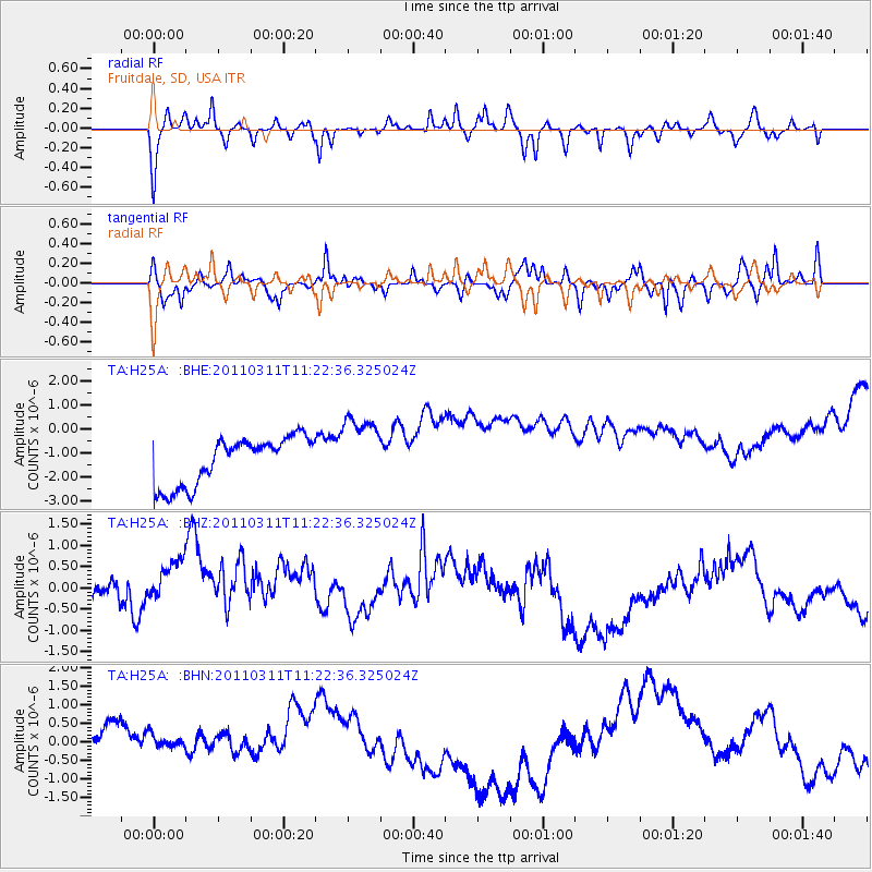
H25A Fruitdale, SD, USA - Earthquake Result Viewer
*The percent match for this event was below the threshold and hence no stack was calculated.
| Earthquake location: |
Near East Coast Of Honshu, Japan |
| Earthquake latitude/longitude: |
35.5/141.8 |
| Earthquake time(UTC): |
2011/03/11 (070) 11:10:58 GMT |
| Earthquake Depth: |
35 km |
| Earthquake Magnitude: |
5.5 MB |
| Earthquake Catalog/Contributor: |
WHDF/NEIC |
|
| Network: |
TA USArray Transportable Network (new EarthScope stations) |
| Station: |
H25A Fruitdale, SD, USA |
| Lat/Lon: |
44.62 N/103.60 W |
| Elevation: |
942 m |
|
| Distance: |
80.6 deg |
| Az: |
41.171 deg |
| Baz: |
311.248 deg |
| Ray Param: |
$rayparam |
*The percent match for this event was below the threshold and hence was not used in the summary stack. |
|
| Radial Match: |
35.64713 % |
| Radial Bump: |
252 |
| Transverse Match: |
27.337645 % |
| Transverse Bump: |
239 |
| SOD ConfigId: |
356183 |
| Insert Time: |
2011-08-14 18:27:39.400 +0000 |
| GWidth: |
2.5 |
| Max Bumps: |
400 |
| Tol: |
0.001 |
|
Signal To Noise
| Channel | StoN | STA | LTA |
| TA:H25A: :BHZ:20110311T11:22:36.325024Z | 1.3630252 | 1.2352344E-6 | 9.062448E-7 |
| TA:H25A: :BHN:20110311T11:22:36.325024Z | 0.39529777 | 4.3811087E-7 | 1.108306E-6 |
| TA:H25A: :BHE:20110311T11:22:36.325024Z | 1.4971179 | 1.4723945E-6 | 9.83486E-7 |
| Arrivals |
| Ps | |
| PpPs | |
| PsPs/PpSs | |


