You are here: Home > Network List > TA - USArray Transportable Network (new EarthScope stations) Stations List
> Station P35A Duane Minner, Soldier, KS, USA > Earthquake Result Viewer
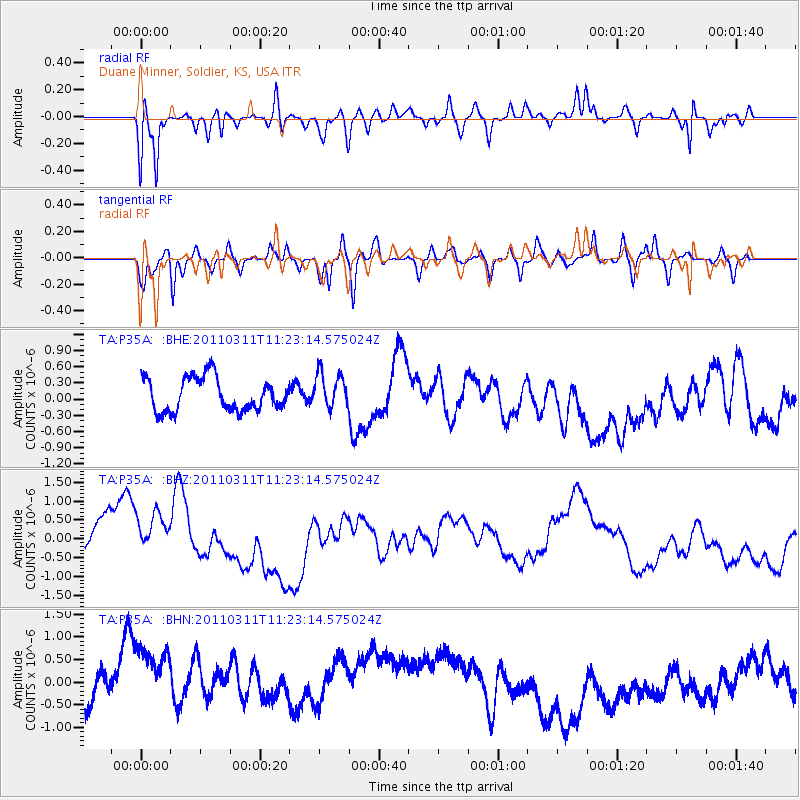
P35A Duane Minner, Soldier, KS, USA - Earthquake Result Viewer
*The percent match for this event was below the threshold and hence no stack was calculated.
| Earthquake location: |
Near East Coast Of Honshu, Japan |
| Earthquake latitude/longitude: |
35.5/141.8 |
| Earthquake time(UTC): |
2011/03/11 (070) 11:10:58 GMT |
| Earthquake Depth: |
35 km |
| Earthquake Magnitude: |
5.5 MB |
| Earthquake Catalog/Contributor: |
WHDF/NEIC |
|
| Network: |
TA USArray Transportable Network (new EarthScope stations) |
| Station: |
P35A Duane Minner, Soldier, KS, USA |
| Lat/Lon: |
39.53 N/96.02 W |
| Elevation: |
418 m |
|
| Distance: |
88.2 deg |
| Az: |
40.935 deg |
| Baz: |
316.294 deg |
| Ray Param: |
$rayparam |
*The percent match for this event was below the threshold and hence was not used in the summary stack. |
|
| Radial Match: |
67.02314 % |
| Radial Bump: |
400 |
| Transverse Match: |
39.336575 % |
| Transverse Bump: |
400 |
| SOD ConfigId: |
356183 |
| Insert Time: |
2011-08-14 18:56:42.567 +0000 |
| GWidth: |
2.5 |
| Max Bumps: |
400 |
| Tol: |
0.001 |
|
Signal To Noise
| Channel | StoN | STA | LTA |
| TA:P35A: :BHZ:20110311T11:23:14.575024Z | 1.195535 | 8.8709396E-7 | 7.4200585E-7 |
| TA:P35A: :BHN:20110311T11:23:14.575024Z | 2.2926424 | 1.5828543E-6 | 6.904061E-7 |
| TA:P35A: :BHE:20110311T11:23:14.575024Z | 1.0629022 | 3.2503974E-7 | 3.05804E-7 |
| Arrivals |
| Ps | |
| PpPs | |
| PsPs/PpSs | |


