You are here: Home > Network List > AZ - ANZA Regional Network Stations List
> Station LVA2 AZ.LVA2 > Earthquake Result Viewer
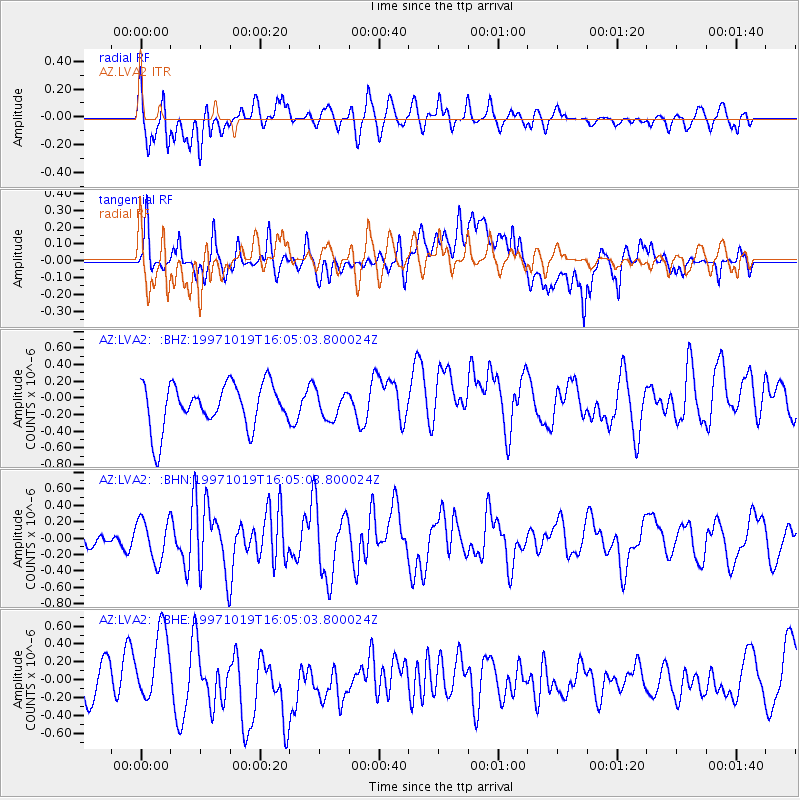
LVA2 AZ.LVA2 - Earthquake Result Viewer
*The percent match for this event was below the threshold and hence no stack was calculated.
| Earthquake location: |
Tonga Islands |
| Earthquake latitude/longitude: |
-21.8/-175.0 |
| Earthquake time(UTC): |
1997/10/19 (292) 15:53:38 GMT |
| Earthquake Depth: |
33 km |
| Earthquake Magnitude: |
5.6 MB, 5.9 MS |
| Earthquake Catalog/Contributor: |
WHDF/NEIC |
|
| Network: |
AZ ANZA Regional Network |
| Station: |
LVA2 AZ.LVA2 |
| Lat/Lon: |
33.35 N/116.56 W |
| Elevation: |
1435 m |
|
| Distance: |
78.2 deg |
| Az: |
46.784 deg |
| Baz: |
234.018 deg |
| Ray Param: |
$rayparam |
*The percent match for this event was below the threshold and hence was not used in the summary stack. |
|
| Radial Match: |
40.69305 % |
| Radial Bump: |
400 |
| Transverse Match: |
58.966125 % |
| Transverse Bump: |
400 |
| SOD ConfigId: |
4480 |
| Insert Time: |
2010-02-26 19:55:13.005 +0000 |
| GWidth: |
2.5 |
| Max Bumps: |
400 |
| Tol: |
0.001 |
|
Signal To Noise
| Channel | StoN | STA | LTA |
| AZ:LVA2: :BHN:19971019T16:05:03.800024Z | 1.3847961 | 2.5211367E-7 | 1.8205833E-7 |
| AZ:LVA2: :BHE:19971019T16:05:03.800024Z | 1.9018507 | 3.7836776E-7 | 1.9894713E-7 |
| AZ:LVA2: :BHZ:19971019T16:05:03.800024Z | 0.598838 | 1.5896966E-7 | 2.6546354E-7 |
| Arrivals |
| Ps | |
| PpPs | |
| PsPs/PpSs | |


