You are here: Home > Network List > TA - USArray Transportable Network (new EarthScope stations) Stations List
> Station N38A Joe's South Fork Station, Corydon, IA, USA > Earthquake Result Viewer
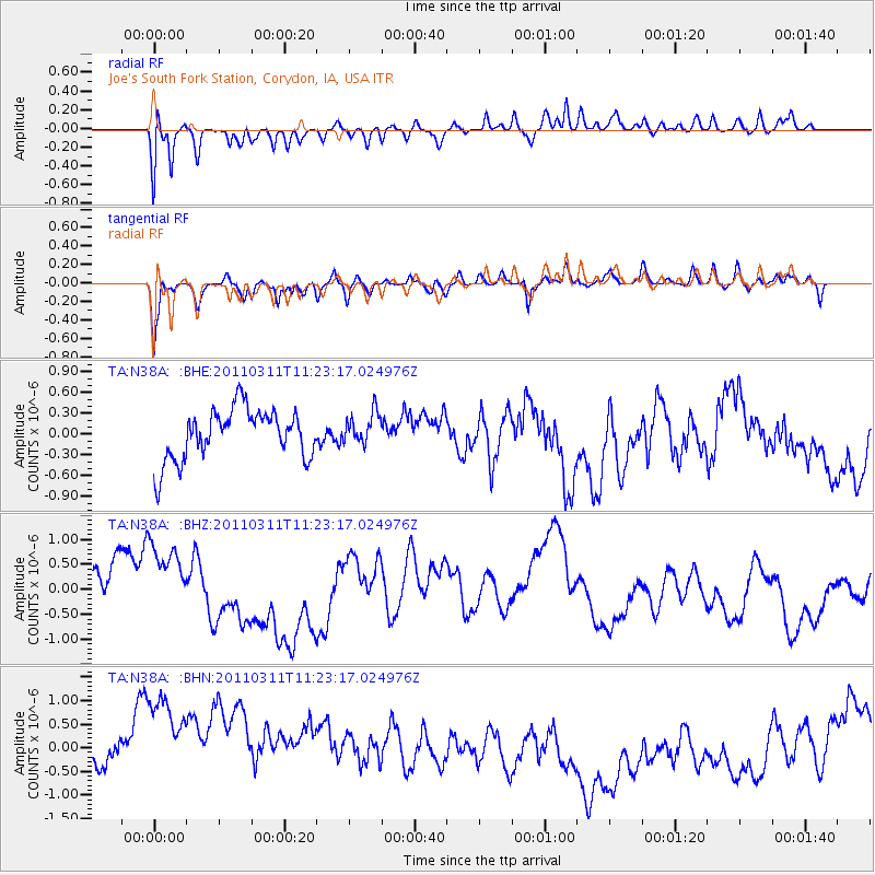
N38A Joe's South Fork Station, Corydon, IA, USA - Earthquake Result Viewer
*The percent match for this event was below the threshold and hence no stack was calculated.
| Earthquake location: |
Near East Coast Of Honshu, Japan |
| Earthquake latitude/longitude: |
35.5/141.8 |
| Earthquake time(UTC): |
2011/03/11 (070) 11:10:58 GMT |
| Earthquake Depth: |
35 km |
| Earthquake Magnitude: |
5.5 MB |
| Earthquake Catalog/Contributor: |
WHDF/NEIC |
|
| Network: |
TA USArray Transportable Network (new EarthScope stations) |
| Station: |
N38A Joe's South Fork Station, Corydon, IA, USA |
| Lat/Lon: |
40.79 N/93.24 W |
| Elevation: |
317 m |
|
| Distance: |
88.7 deg |
| Az: |
38.511 deg |
| Baz: |
318.018 deg |
| Ray Param: |
$rayparam |
*The percent match for this event was below the threshold and hence was not used in the summary stack. |
|
| Radial Match: |
53.226368 % |
| Radial Bump: |
400 |
| Transverse Match: |
40.35935 % |
| Transverse Bump: |
328 |
| SOD ConfigId: |
356183 |
| Insert Time: |
2011-08-14 19:21:38.139 +0000 |
| GWidth: |
2.5 |
| Max Bumps: |
400 |
| Tol: |
0.001 |
|
Signal To Noise
| Channel | StoN | STA | LTA |
| TA:N38A: :BHZ:20110311T11:23:17.024976Z | 1.2640975 | 8.887889E-7 | 7.031016E-7 |
| TA:N38A: :BHN:20110311T11:23:17.024976Z | 1.9274316 | 2.242652E-6 | 1.1635443E-6 |
| TA:N38A: :BHE:20110311T11:23:17.024976Z | 0.6336236 | 2.2984365E-7 | 3.6274477E-7 |
| Arrivals |
| Ps | |
| PpPs | |
| PsPs/PpSs | |


