You are here: Home > Network List > TA - USArray Transportable Network (new EarthScope stations) Stations List
> Station X39A Fountain Ranch, Mena, AR, USA > Earthquake Result Viewer
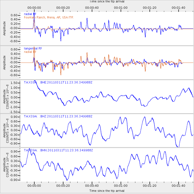
X39A Fountain Ranch, Mena, AR, USA - Earthquake Result Viewer
*The percent match for this event was below the threshold and hence no stack was calculated.
| Earthquake location: |
Near East Coast Of Honshu, Japan |
| Earthquake latitude/longitude: |
35.5/141.8 |
| Earthquake time(UTC): |
2011/03/11 (070) 11:10:58 GMT |
| Earthquake Depth: |
35 km |
| Earthquake Magnitude: |
5.5 MB |
| Earthquake Catalog/Contributor: |
WHDF/NEIC |
|
| Network: |
TA USArray Transportable Network (new EarthScope stations) |
| Station: |
X39A Fountain Ranch, Mena, AR, USA |
| Lat/Lon: |
34.51 N/94.11 W |
| Elevation: |
326 m |
|
| Distance: |
92.9 deg |
| Az: |
43.247 deg |
| Baz: |
317.415 deg |
| Ray Param: |
$rayparam |
*The percent match for this event was below the threshold and hence was not used in the summary stack. |
|
| Radial Match: |
70.82748 % |
| Radial Bump: |
312 |
| Transverse Match: |
74.99687 % |
| Transverse Bump: |
355 |
| SOD ConfigId: |
356183 |
| Insert Time: |
2011-08-14 19:25:42.574 +0000 |
| GWidth: |
2.5 |
| Max Bumps: |
400 |
| Tol: |
0.001 |
|
Signal To Noise
| Channel | StoN | STA | LTA |
| TA:X39A: :BHZ:20110311T11:23:36.349988Z | 1.1711366 | 5.0084145E-7 | 4.2765413E-7 |
| TA:X39A: :BHN:20110311T11:23:36.349988Z | 1.095363 | 4.5761954E-7 | 4.1777886E-7 |
| TA:X39A: :BHE:20110311T11:23:36.349988Z | 0.8453084 | 5.352366E-7 | 6.33185E-7 |
| Arrivals |
| Ps | |
| PpPs | |
| PsPs/PpSs | |


