You are here: Home > Network List > US - United States National Seismic Network Stations List
> Station WMOK Wichita Mountains, Oklahoma, USA > Earthquake Result Viewer
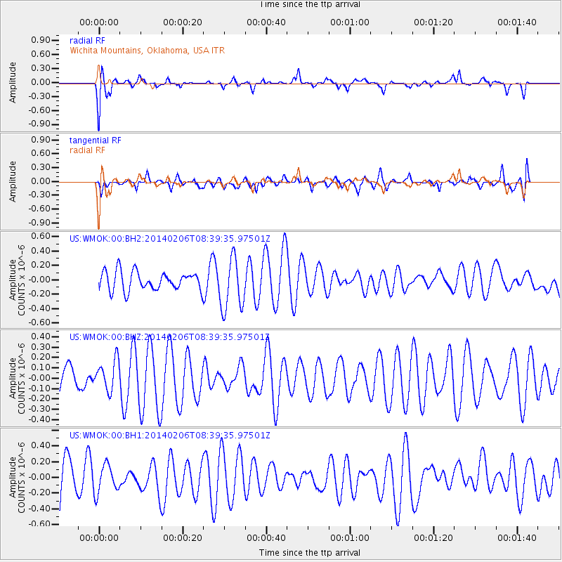
WMOK Wichita Mountains, Oklahoma, USA - Earthquake Result Viewer
*The percent match for this event was below the threshold and hence no stack was calculated.
| Earthquake location: |
Fiji Islands Region |
| Earthquake latitude/longitude: |
-21.9/-177.9 |
| Earthquake time(UTC): |
2014/02/06 (037) 08:27:31 GMT |
| Earthquake Depth: |
374 km |
| Earthquake Magnitude: |
5.4 MW |
| Earthquake Catalog/Contributor: |
ISC/ISC |
|
| Network: |
US United States National Seismic Network |
| Station: |
WMOK Wichita Mountains, Oklahoma, USA |
| Lat/Lon: |
34.74 N/98.78 W |
| Elevation: |
486 m |
|
| Distance: |
93.8 deg |
| Az: |
54.151 deg |
| Baz: |
246.044 deg |
| Ray Param: |
$rayparam |
*The percent match for this event was below the threshold and hence was not used in the summary stack. |
|
| Radial Match: |
55.33037 % |
| Radial Bump: |
400 |
| Transverse Match: |
54.149734 % |
| Transverse Bump: |
400 |
| SOD ConfigId: |
3390531 |
| Insert Time: |
2019-04-10 06:21:06.022 +0000 |
| GWidth: |
2.5 |
| Max Bumps: |
400 |
| Tol: |
0.001 |
|
Signal To Noise
| Channel | StoN | STA | LTA |
| US:WMOK:00:BHZ:20140206T08:39:35.97501Z | 0.5250381 | 1.4851304E-7 | 2.8286144E-7 |
| US:WMOK:00:BH1:20140206T08:39:35.97501Z | 0.50120765 | 1.7811143E-7 | 3.5536453E-7 |
| US:WMOK:00:BH2:20140206T08:39:35.97501Z | 2.8330927 | 3.6616984E-7 | 1.292474E-7 |
| Arrivals |
| Ps | |
| PpPs | |
| PsPs/PpSs | |


