You are here: Home > Network List > UW - Pacific Northwest Regional Seismic Network Stations List
> Station HOOD Mt Hood Meadows, OR CREST BB SMO > Earthquake Result Viewer
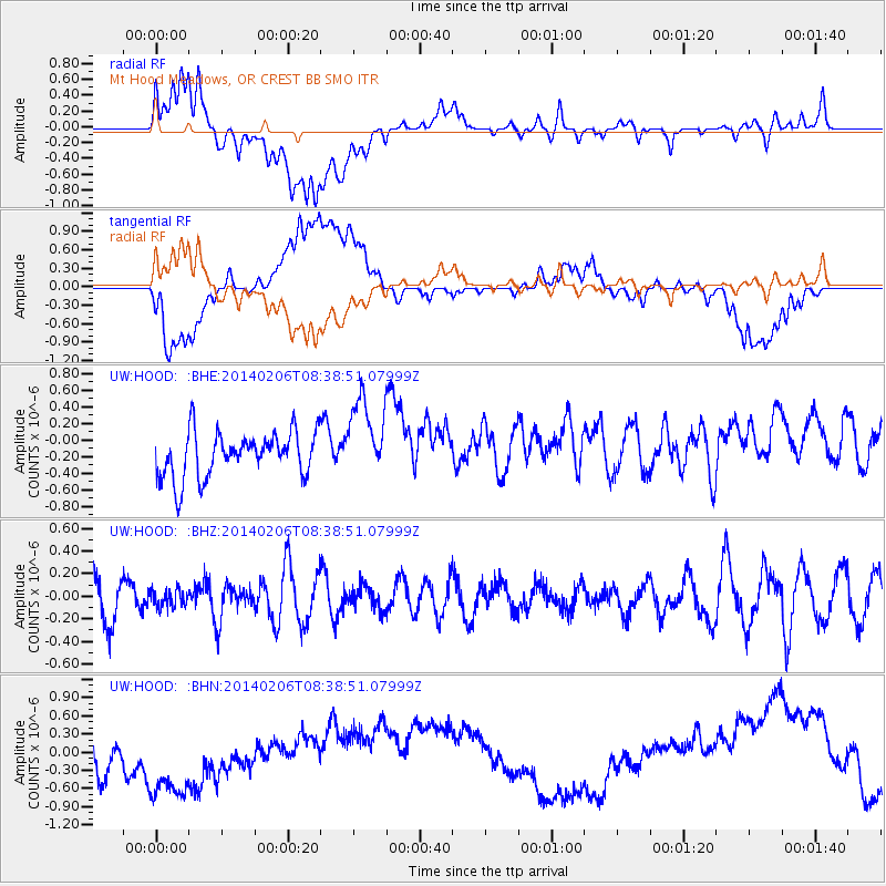
HOOD Mt Hood Meadows, OR CREST BB SMO - Earthquake Result Viewer
*The percent match for this event was below the threshold and hence no stack was calculated.
| Earthquake location: |
Fiji Islands Region |
| Earthquake latitude/longitude: |
-21.9/-177.9 |
| Earthquake time(UTC): |
2014/02/06 (037) 08:27:31 GMT |
| Earthquake Depth: |
374 km |
| Earthquake Magnitude: |
5.4 MW |
| Earthquake Catalog/Contributor: |
ISC/ISC |
|
| Network: |
UW Pacific Northwest Regional Seismic Network |
| Station: |
HOOD Mt Hood Meadows, OR CREST BB SMO |
| Lat/Lon: |
45.32 N/121.65 W |
| Elevation: |
1520 m |
|
| Distance: |
84.2 deg |
| Az: |
36.132 deg |
| Baz: |
230.898 deg |
| Ray Param: |
$rayparam |
*The percent match for this event was below the threshold and hence was not used in the summary stack. |
|
| Radial Match: |
31.320503 % |
| Radial Bump: |
400 |
| Transverse Match: |
28.281431 % |
| Transverse Bump: |
400 |
| SOD ConfigId: |
3390531 |
| Insert Time: |
2019-04-10 06:21:15.765 +0000 |
| GWidth: |
2.5 |
| Max Bumps: |
400 |
| Tol: |
0.001 |
|
Signal To Noise
| Channel | StoN | STA | LTA |
| UW:HOOD: :BHZ:20140206T08:38:51.07999Z | 0.48054925 | 7.422708E-8 | 1.5446301E-7 |
| UW:HOOD: :BHN:20140206T08:38:51.07999Z | 1.8727742 | 9.378961E-7 | 5.0080575E-7 |
| UW:HOOD: :BHE:20140206T08:38:51.07999Z | 1.8403904 | 4.9578784E-7 | 2.6939276E-7 |
| Arrivals |
| Ps | |
| PpPs | |
| PsPs/PpSs | |


