You are here: Home > Network List > IC - New China Digital Seismograph Network Stations List
> Station KMI Kunming, Yunnan Province, China > Earthquake Result Viewer
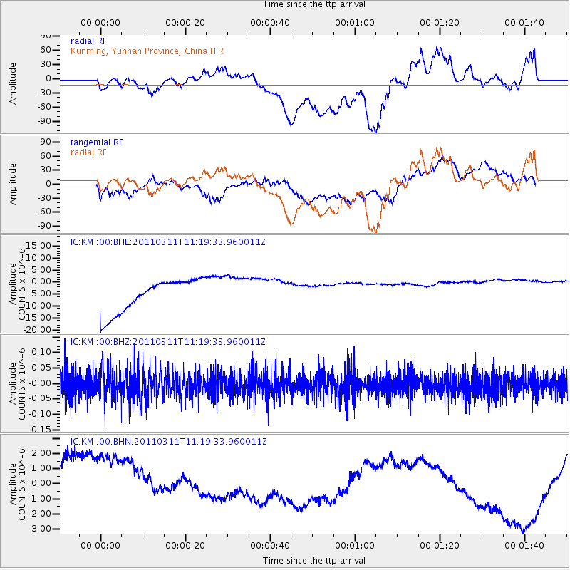
KMI Kunming, Yunnan Province, China - Earthquake Result Viewer
*The percent match for this event was below the threshold and hence no stack was calculated.
| Earthquake location: |
Near East Coast Of Honshu, Japan |
| Earthquake latitude/longitude: |
36.4/141.8 |
| Earthquake time(UTC): |
2011/03/11 (070) 11:13:12 GMT |
| Earthquake Depth: |
26 km |
| Earthquake Magnitude: |
5.5 MB |
| Earthquake Catalog/Contributor: |
WHDF/NEIC |
|
| Network: |
IC New China Digital Seismograph Network |
| Station: |
KMI Kunming, Yunnan Province, China |
| Lat/Lon: |
25.12 N/102.74 E |
| Elevation: |
1975 m |
|
| Distance: |
35.2 deg |
| Az: |
262.51 deg |
| Baz: |
61.964 deg |
| Ray Param: |
$rayparam |
*The percent match for this event was below the threshold and hence was not used in the summary stack. |
|
| Radial Match: |
29.466188 % |
| Radial Bump: |
400 |
| Transverse Match: |
49.772106 % |
| Transverse Bump: |
400 |
| SOD ConfigId: |
356183 |
| Insert Time: |
2011-08-14 20:39:01.817 +0000 |
| GWidth: |
2.5 |
| Max Bumps: |
400 |
| Tol: |
0.001 |
|
Signal To Noise
| Channel | StoN | STA | LTA |
| IC:KMI:00:BHZ:20110311T11:19:33.960011Z | 1.0106453 | 4.77192E-8 | 4.721657E-8 |
| IC:KMI:00:BHN:20110311T11:19:33.960011Z | 1.0149574 | 2.8419336E-6 | 2.800052E-6 |
| IC:KMI:00:BHE:20110311T11:19:33.960011Z | 1.0801383 | 7.356048E-6 | 6.810283E-6 |
| Arrivals |
| Ps | |
| PpPs | |
| PsPs/PpSs | |


