You are here: Home > Network List > AZ - ANZA Regional Network Stations List
> Station LVA2 AZ.LVA2 > Earthquake Result Viewer
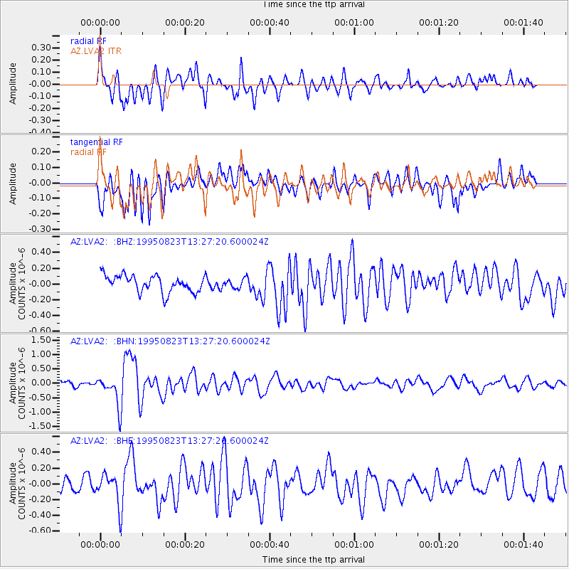
LVA2 AZ.LVA2 - Earthquake Result Viewer
*The percent match for this event was below the threshold and hence no stack was calculated.
| Earthquake location: |
Pacific-Antarctic Ridge |
| Earthquake latitude/longitude: |
-56.8/-141.7 |
| Earthquake time(UTC): |
1995/08/23 (235) 13:14:42 GMT |
| Earthquake Depth: |
10 km |
| Earthquake Magnitude: |
5.9 MB, 5.6 MS, 5.5 UNKNOWN, 6.2 MW |
| Earthquake Catalog/Contributor: |
WHDF/NEIC |
|
| Network: |
AZ ANZA Regional Network |
| Station: |
LVA2 AZ.LVA2 |
| Lat/Lon: |
33.35 N/116.56 W |
| Elevation: |
1435 m |
|
| Distance: |
92.2 deg |
| Az: |
20.825 deg |
| Baz: |
193.531 deg |
| Ray Param: |
$rayparam |
*The percent match for this event was below the threshold and hence was not used in the summary stack. |
|
| Radial Match: |
79.18023 % |
| Radial Bump: |
400 |
| Transverse Match: |
68.53491 % |
| Transverse Bump: |
400 |
| SOD ConfigId: |
4480 |
| Insert Time: |
2010-02-26 19:55:44.459 +0000 |
| GWidth: |
2.5 |
| Max Bumps: |
400 |
| Tol: |
0.001 |
|
Signal To Noise
| Channel | StoN | STA | LTA |
| AZ:LVA2: :BHN:19950823T13:27:20.600024Z | 6.9175825 | 5.418173E-7 | 7.832467E-8 |
| AZ:LVA2: :BHE:19950823T13:27:20.600024Z | 2.809206 | 1.9064407E-7 | 6.786404E-8 |
| AZ:LVA2: :BHZ:19950823T13:27:20.600024Z | 0.57481205 | 6.110011E-8 | 1.0629581E-7 |
| Arrivals |
| Ps | |
| PpPs | |
| PsPs/PpSs | |


