You are here: Home > Network List > TA - USArray Transportable Network (new EarthScope stations) Stations List
> Station 534A Blanco, TX, USA > Earthquake Result Viewer
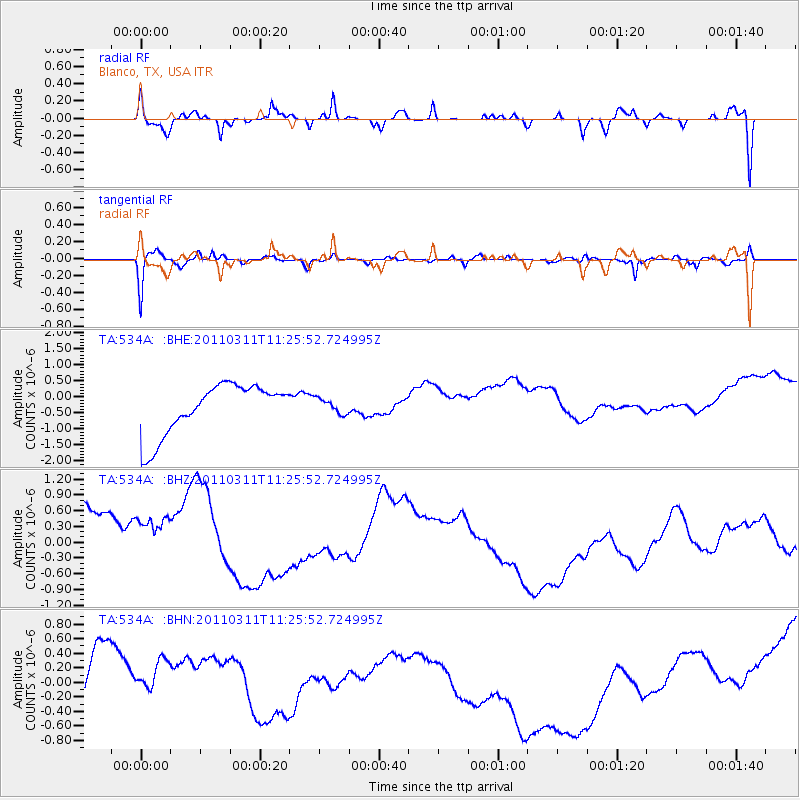
534A Blanco, TX, USA - Earthquake Result Viewer
*The percent match for this event was below the threshold and hence no stack was calculated.
| Earthquake location: |
Near East Coast Of Honshu, Japan |
| Earthquake latitude/longitude: |
36.4/141.8 |
| Earthquake time(UTC): |
2011/03/11 (070) 11:13:12 GMT |
| Earthquake Depth: |
26 km |
| Earthquake Magnitude: |
5.5 MB |
| Earthquake Catalog/Contributor: |
WHDF/NEIC |
|
| Network: |
TA USArray Transportable Network (new EarthScope stations) |
| Station: |
534A Blanco, TX, USA |
| Lat/Lon: |
30.03 N/98.48 W |
| Elevation: |
461 m |
|
| Distance: |
93.0 deg |
| Az: |
48.94 deg |
| Baz: |
315.44 deg |
| Ray Param: |
$rayparam |
*The percent match for this event was below the threshold and hence was not used in the summary stack. |
|
| Radial Match: |
22.527168 % |
| Radial Bump: |
272 |
| Transverse Match: |
57.148903 % |
| Transverse Bump: |
360 |
| SOD ConfigId: |
356183 |
| Insert Time: |
2011-08-14 21:19:42.425 +0000 |
| GWidth: |
2.5 |
| Max Bumps: |
400 |
| Tol: |
0.001 |
|
Signal To Noise
| Channel | StoN | STA | LTA |
| TA:534A: :BHZ:20110311T11:25:52.724995Z | 1.1118609 | 1.2660606E-6 | 1.1386861E-6 |
| TA:534A: :BHN:20110311T11:25:52.724995Z | 0.8643517 | 3.1430778E-7 | 3.6363414E-7 |
| TA:534A: :BHE:20110311T11:25:52.724995Z | 0.2927111 | 2.300212E-7 | 7.8583014E-7 |
| Arrivals |
| Ps | |
| PpPs | |
| PsPs/PpSs | |


