You are here: Home > Network List > TA - USArray Transportable Network (new EarthScope stations) Stations List
> Station 434A Burnet, TX, USA > Earthquake Result Viewer
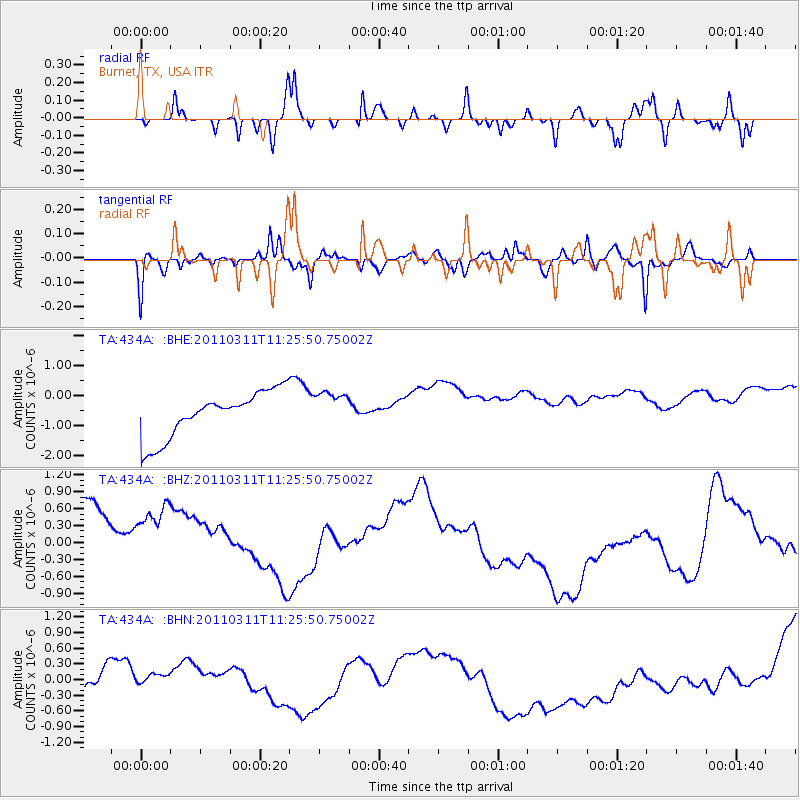
434A Burnet, TX, USA - Earthquake Result Viewer
*The percent match for this event was below the threshold and hence no stack was calculated.
| Earthquake location: |
Near East Coast Of Honshu, Japan |
| Earthquake latitude/longitude: |
36.4/141.8 |
| Earthquake time(UTC): |
2011/03/11 (070) 11:13:12 GMT |
| Earthquake Depth: |
26 km |
| Earthquake Magnitude: |
5.5 MB |
| Earthquake Catalog/Contributor: |
WHDF/NEIC |
|
| Network: |
TA USArray Transportable Network (new EarthScope stations) |
| Station: |
434A Burnet, TX, USA |
| Lat/Lon: |
30.81 N/98.27 W |
| Elevation: |
462 m |
|
| Distance: |
92.6 deg |
| Az: |
48.263 deg |
| Baz: |
315.578 deg |
| Ray Param: |
$rayparam |
*The percent match for this event was below the threshold and hence was not used in the summary stack. |
|
| Radial Match: |
15.545949 % |
| Radial Bump: |
226 |
| Transverse Match: |
63.02656 % |
| Transverse Bump: |
317 |
| SOD ConfigId: |
356183 |
| Insert Time: |
2011-08-14 21:20:51.996 +0000 |
| GWidth: |
2.5 |
| Max Bumps: |
400 |
| Tol: |
0.001 |
|
Signal To Noise
| Channel | StoN | STA | LTA |
| TA:434A: :BHZ:20110311T11:25:50.75002Z | 1.0397595 | 1.365394E-6 | 1.3131826E-6 |
| TA:434A: :BHN:20110311T11:25:50.75002Z | 0.39723232 | 1.1824279E-7 | 2.9766656E-7 |
| TA:434A: :BHE:20110311T11:25:50.75002Z | 0.80957353 | 6.250253E-7 | 7.720426E-7 |
| Arrivals |
| Ps | |
| PpPs | |
| PsPs/PpSs | |


