You are here: Home > Network List > TA - USArray Transportable Network (new EarthScope stations) Stations List
> Station G36A St. Michael, MN, USA > Earthquake Result Viewer
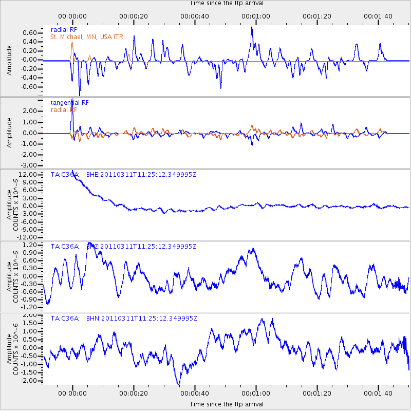
G36A St. Michael, MN, USA - Earthquake Result Viewer
*The percent match for this event was below the threshold and hence no stack was calculated.
| Earthquake location: |
Near East Coast Of Honshu, Japan |
| Earthquake latitude/longitude: |
36.4/141.8 |
| Earthquake time(UTC): |
2011/03/11 (070) 11:13:12 GMT |
| Earthquake Depth: |
26 km |
| Earthquake Magnitude: |
5.5 MB |
| Earthquake Catalog/Contributor: |
WHDF/NEIC |
|
| Network: |
TA USArray Transportable Network (new EarthScope stations) |
| Station: |
G36A St. Michael, MN, USA |
| Lat/Lon: |
45.23 N/93.75 W |
| Elevation: |
293 m |
|
| Distance: |
84.5 deg |
| Az: |
35.815 deg |
| Baz: |
318.062 deg |
| Ray Param: |
$rayparam |
*The percent match for this event was below the threshold and hence was not used in the summary stack. |
|
| Radial Match: |
60.117306 % |
| Radial Bump: |
382 |
| Transverse Match: |
58.123676 % |
| Transverse Bump: |
324 |
| SOD ConfigId: |
356183 |
| Insert Time: |
2011-08-14 21:53:33.073 +0000 |
| GWidth: |
2.5 |
| Max Bumps: |
400 |
| Tol: |
0.001 |
|
Signal To Noise
| Channel | StoN | STA | LTA |
| TA:G36A: :BHZ:20110311T11:25:12.349995Z | 2.1215985 | 8.9456347E-7 | 4.2164598E-7 |
| TA:G36A: :BHN:20110311T11:25:12.349995Z | 0.88211477 | 1.2543153E-6 | 1.4219411E-6 |
| TA:G36A: :BHE:20110311T11:25:12.349995Z | 1.156623 | 4.6318014E-6 | 4.0045907E-6 |
| Arrivals |
| Ps | |
| PpPs | |
| PsPs/PpSs | |


