You are here: Home > Network List > TA - USArray Transportable Network (new EarthScope stations) Stations List
> Station H37A Dierke Farm, Cannon Falls, MN, USA > Earthquake Result Viewer
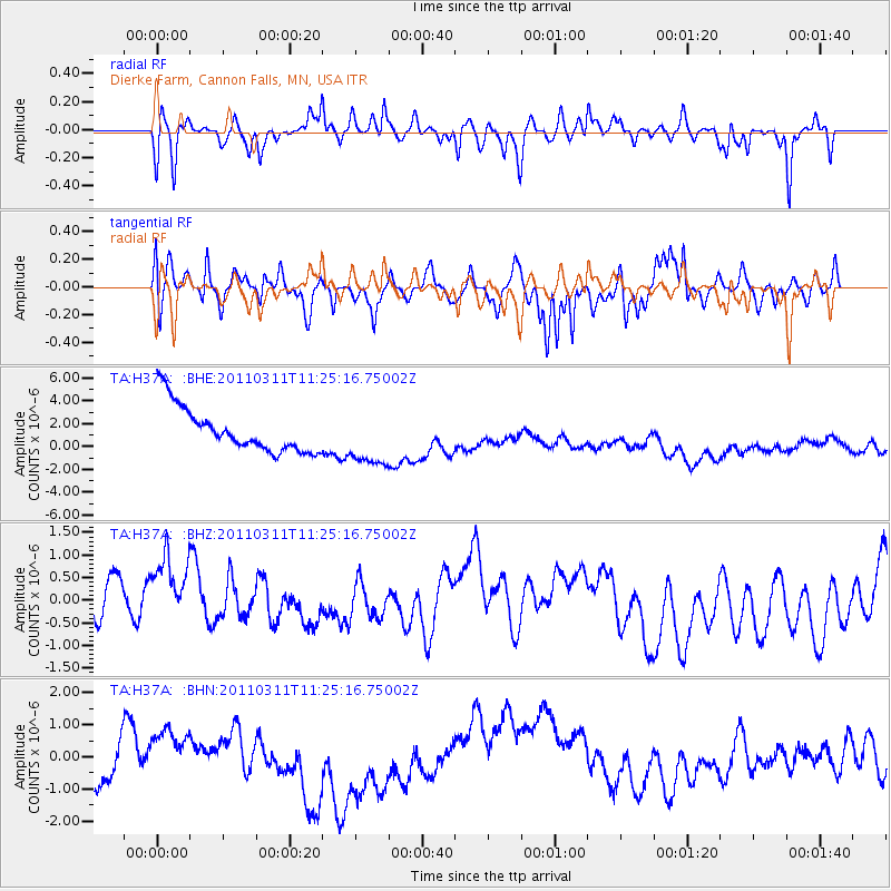
H37A Dierke Farm, Cannon Falls, MN, USA - Earthquake Result Viewer
*The percent match for this event was below the threshold and hence no stack was calculated.
| Earthquake location: |
Near East Coast Of Honshu, Japan |
| Earthquake latitude/longitude: |
36.4/141.8 |
| Earthquake time(UTC): |
2011/03/11 (070) 11:13:12 GMT |
| Earthquake Depth: |
26 km |
| Earthquake Magnitude: |
5.5 MB |
| Earthquake Catalog/Contributor: |
WHDF/NEIC |
|
| Network: |
TA USArray Transportable Network (new EarthScope stations) |
| Station: |
H37A Dierke Farm, Cannon Falls, MN, USA |
| Lat/Lon: |
44.58 N/92.92 W |
| Elevation: |
321 m |
|
| Distance: |
85.4 deg |
| Az: |
35.807 deg |
| Baz: |
318.647 deg |
| Ray Param: |
$rayparam |
*The percent match for this event was below the threshold and hence was not used in the summary stack. |
|
| Radial Match: |
60.03459 % |
| Radial Bump: |
385 |
| Transverse Match: |
58.388744 % |
| Transverse Bump: |
391 |
| SOD ConfigId: |
356183 |
| Insert Time: |
2011-08-14 21:56:29.506 +0000 |
| GWidth: |
2.5 |
| Max Bumps: |
400 |
| Tol: |
0.001 |
|
Signal To Noise
| Channel | StoN | STA | LTA |
| TA:H37A: :BHZ:20110311T11:25:16.75002Z | 1.5444463 | 1.0386775E-6 | 6.725242E-7 |
| TA:H37A: :BHN:20110311T11:25:16.75002Z | 0.46153432 | 4.563085E-7 | 9.886774E-7 |
| TA:H37A: :BHE:20110311T11:25:16.75002Z | 1.2686316 | 2.4993274E-6 | 1.9700972E-6 |
| Arrivals |
| Ps | |
| PpPs | |
| PsPs/PpSs | |


