You are here: Home > Network List > TA - USArray Transportable Network (new EarthScope stations) Stations List
> Station N54A Moraine State Park, Portersville, PA, USA > Earthquake Result Viewer
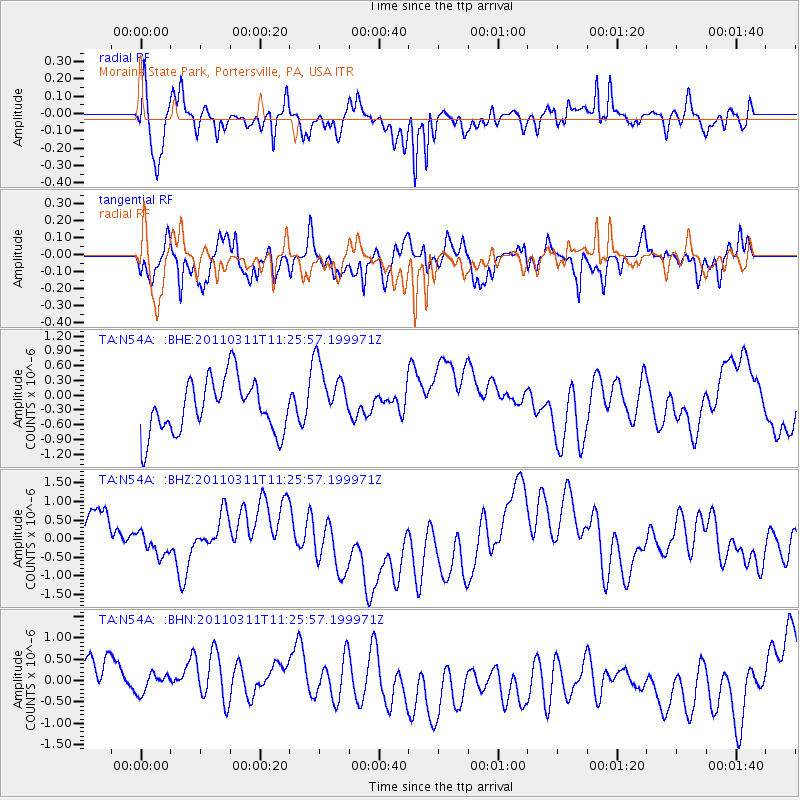
N54A Moraine State Park, Portersville, PA, USA - Earthquake Result Viewer
*The percent match for this event was below the threshold and hence no stack was calculated.
| Earthquake location: |
Near East Coast Of Honshu, Japan |
| Earthquake latitude/longitude: |
36.4/141.8 |
| Earthquake time(UTC): |
2011/03/11 (070) 11:13:12 GMT |
| Earthquake Depth: |
26 km |
| Earthquake Magnitude: |
5.5 MB |
| Earthquake Catalog/Contributor: |
WHDF/NEIC |
|
| Network: |
TA USArray Transportable Network (new EarthScope stations) |
| Station: |
N54A Moraine State Park, Portersville, PA, USA |
| Lat/Lon: |
40.96 N/79.99 W |
| Elevation: |
408 m |
|
| Distance: |
94.0 deg |
| Az: |
30.378 deg |
| Baz: |
327.393 deg |
| Ray Param: |
$rayparam |
*The percent match for this event was below the threshold and hence was not used in the summary stack. |
|
| Radial Match: |
57.079678 % |
| Radial Bump: |
400 |
| Transverse Match: |
64.54042 % |
| Transverse Bump: |
400 |
| SOD ConfigId: |
356183 |
| Insert Time: |
2011-08-14 22:02:14.980 +0000 |
| GWidth: |
2.5 |
| Max Bumps: |
400 |
| Tol: |
0.001 |
|
Signal To Noise
| Channel | StoN | STA | LTA |
| TA:N54A: :BHZ:20110311T11:25:57.199971Z | 0.5867269 | 3.1994384E-7 | 5.4530284E-7 |
| TA:N54A: :BHN:20110311T11:25:57.199971Z | 0.5435652 | 4.264844E-7 | 7.8460573E-7 |
| TA:N54A: :BHE:20110311T11:25:57.199971Z | 1.2216041 | 6.622413E-7 | 5.4210795E-7 |
| Arrivals |
| Ps | |
| PpPs | |
| PsPs/PpSs | |


