You are here: Home > Network List > AZ - ANZA Regional Network Stations List
> Station LVA2 AZ.LVA2 > Earthquake Result Viewer
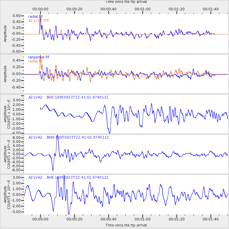
LVA2 AZ.LVA2 - Earthquake Result Viewer
*The percent match for this event was below the threshold and hence no stack was calculated.
| Earthquake location: |
Near Coast Of Peru |
| Earthquake latitude/longitude: |
-10.5/-78.7 |
| Earthquake time(UTC): |
1995/09/23 (266) 22:31:58 GMT |
| Earthquake Depth: |
73 km |
| Earthquake Magnitude: |
5.9 MB, 6.5 UNKNOWN, 6.4 MW |
| Earthquake Catalog/Contributor: |
WHDF/NEIC |
|
| Network: |
AZ ANZA Regional Network |
| Station: |
LVA2 AZ.LVA2 |
| Lat/Lon: |
33.35 N/116.56 W |
| Elevation: |
1435 m |
|
| Distance: |
56.6 deg |
| Az: |
322.021 deg |
| Baz: |
133.698 deg |
| Ray Param: |
$rayparam |
*The percent match for this event was below the threshold and hence was not used in the summary stack. |
|
| Radial Match: |
73.76846 % |
| Radial Bump: |
400 |
| Transverse Match: |
68.952324 % |
| Transverse Bump: |
400 |
| SOD ConfigId: |
4480 |
| Insert Time: |
2010-02-26 19:56:24.427 +0000 |
| GWidth: |
2.5 |
| Max Bumps: |
400 |
| Tol: |
0.001 |
|
Signal To Noise
| Channel | StoN | STA | LTA |
| AZ:LVA2: :BHN:19950923T22:41:02.974011Z | 0.95681643 | 4.4429126E-7 | 4.643433E-7 |
| AZ:LVA2: :BHE:19950923T22:41:02.974011Z | 0.5745792 | 3.9360722E-7 | 6.850357E-7 |
| AZ:LVA2: :BHZ:19950923T22:41:02.974011Z | 1.4257369 | 1.1394303E-6 | 7.991869E-7 |
| Arrivals |
| Ps | |
| PpPs | |
| PsPs/PpSs | |


