You are here: Home > Network List > AZ - ANZA Regional Network Stations List
> Station LVA2 AZ.LVA2 > Earthquake Result Viewer
LVA2 AZ.LVA2 - Earthquake Result Viewer
*The percent match for this event was below the threshold and hence no stack was calculated.
| Earthquake location: |
Colombia |
| Earthquake latitude/longitude: |
3.9/-75.8 |
| Earthquake time(UTC): |
1997/12/11 (345) 07:56:28 GMT |
| Earthquake Depth: |
178 km |
| Earthquake Magnitude: |
6.0 MB, 6.4 UNKNOWN, 6.3 MW |
| Earthquake Catalog/Contributor: |
WHDF/NEIC |
|
| Network: |
AZ ANZA Regional Network |
| Station: |
LVA2 AZ.LVA2 |
| Lat/Lon: |
33.35 N/116.56 W |
| Elevation: |
1435 m |
|
| Distance: |
48.0 deg |
| Az: |
312.608 deg |
| Baz: |
118.682 deg |
| Ray Param: |
$rayparam |
*The percent match for this event was below the threshold and hence was not used in the summary stack. |
|
| Radial Match: |
68.46867 % |
| Radial Bump: |
400 |
| Transverse Match: |
64.53258 % |
| Transverse Bump: |
400 |
| SOD ConfigId: |
4480 |
| Insert Time: |
2010-02-26 19:56:31.332 +0000 |
| GWidth: |
2.5 |
| Max Bumps: |
400 |
| Tol: |
0.001 |
|
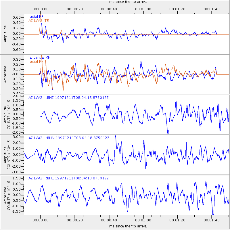
Signal To Noise
| Channel | StoN | STA | LTA |
| AZ:LVA2: :BHN:19971211T08:04:18.875012Z | 1.6028669 | 6.1389426E-7 | 3.8299765E-7 |
| AZ:LVA2: :BHE:19971211T08:04:18.875012Z | 1.6957786 | 5.303571E-7 | 3.1275138E-7 |
| AZ:LVA2: :BHZ:19971211T08:04:18.875012Z | 2.1715515 | 8.2605624E-7 | 3.8039914E-7 |
| Arrivals |
| Ps | |
| PpPs | |
| PsPs/PpSs | |


