You are here: Home > Network List > AZ - ANZA Regional Network Stations List
> Station LVA2 AZ.LVA2 > Earthquake Result Viewer
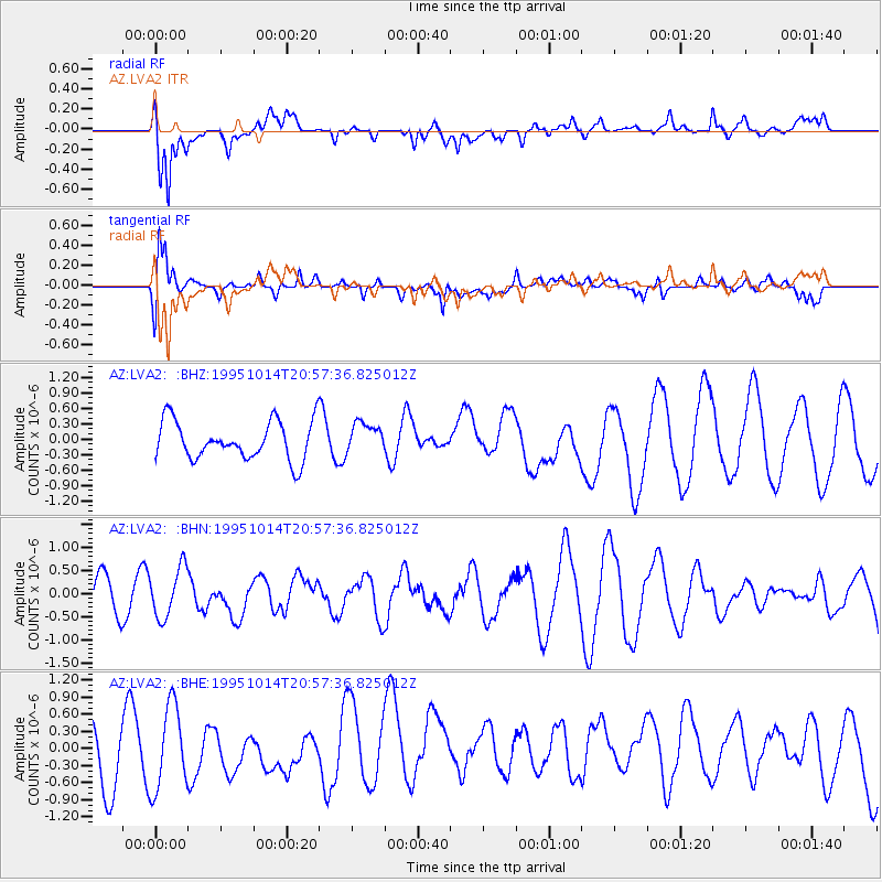
LVA2 AZ.LVA2 - Earthquake Result Viewer
*The percent match for this event was below the threshold and hence no stack was calculated.
| Earthquake location: |
Solomon Islands |
| Earthquake latitude/longitude: |
-6.4/154.5 |
| Earthquake time(UTC): |
1995/10/14 (287) 20:45:00 GMT |
| Earthquake Depth: |
33 km |
| Earthquake Magnitude: |
5.2 MB, 5.9 MS, 6.1 UNKNOWN, 6.0 MW |
| Earthquake Catalog/Contributor: |
WHDF/NEIC |
|
| Network: |
AZ ANZA Regional Network |
| Station: |
LVA2 AZ.LVA2 |
| Lat/Lon: |
33.35 N/116.56 W |
| Elevation: |
1435 m |
|
| Distance: |
92.6 deg |
| Az: |
56.899 deg |
| Baz: |
264.078 deg |
| Ray Param: |
$rayparam |
*The percent match for this event was below the threshold and hence was not used in the summary stack. |
|
| Radial Match: |
50.642086 % |
| Radial Bump: |
400 |
| Transverse Match: |
54.994064 % |
| Transverse Bump: |
400 |
| SOD ConfigId: |
4480 |
| Insert Time: |
2010-02-26 19:56:37.147 +0000 |
| GWidth: |
2.5 |
| Max Bumps: |
400 |
| Tol: |
0.001 |
|
Signal To Noise
| Channel | StoN | STA | LTA |
| AZ:LVA2: :BHN:19951014T20:57:36.825012Z | 1.6559329 | 5.365831E-7 | 3.2403676E-7 |
| AZ:LVA2: :BHE:19951014T20:57:36.825012Z | 1.7922224 | 7.3578616E-7 | 4.10544E-7 |
| AZ:LVA2: :BHZ:19951014T20:57:36.825012Z | 0.7814183 | 2.9288668E-7 | 3.748142E-7 |
| Arrivals |
| Ps | |
| PpPs | |
| PsPs/PpSs | |


