You are here: Home > Network List > TA - USArray Transportable Network (new EarthScope stations) Stations List
> Station H17A Grant Village (NPS), Yellowstone Nt. Park, WY, USA > Earthquake Result Viewer
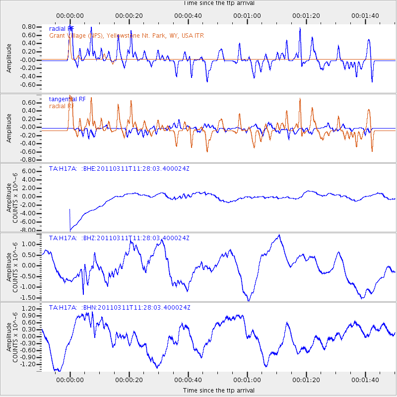
H17A Grant Village (NPS), Yellowstone Nt. Park, WY, USA - Earthquake Result Viewer
*The percent match for this event was below the threshold and hence no stack was calculated.
| Earthquake location: |
Near East Coast Of Honshu, Japan |
| Earthquake latitude/longitude: |
36.6/141.8 |
| Earthquake time(UTC): |
2011/03/11 (070) 11:16:50 GMT |
| Earthquake Depth: |
37 km |
| Earthquake Magnitude: |
5.5 MB |
| Earthquake Catalog/Contributor: |
WHDF/NEIC |
|
| Network: |
TA USArray Transportable Network (new EarthScope stations) |
| Station: |
H17A Grant Village (NPS), Yellowstone Nt. Park, WY, USA |
| Lat/Lon: |
44.40 N/110.58 W |
| Elevation: |
2400 m |
|
| Distance: |
76.1 deg |
| Az: |
44.73 deg |
| Baz: |
307.839 deg |
| Ray Param: |
$rayparam |
*The percent match for this event was below the threshold and hence was not used in the summary stack. |
|
| Radial Match: |
66.29849 % |
| Radial Bump: |
400 |
| Transverse Match: |
44.27832 % |
| Transverse Bump: |
316 |
| SOD ConfigId: |
356183 |
| Insert Time: |
2011-08-14 23:32:31.920 +0000 |
| GWidth: |
2.5 |
| Max Bumps: |
400 |
| Tol: |
0.001 |
|
Signal To Noise
| Channel | StoN | STA | LTA |
| TA:H17A: :BHZ:20110311T11:28:03.400024Z | 0.6391366 | 4.5067992E-7 | 7.051387E-7 |
| TA:H17A: :BHN:20110311T11:28:03.400024Z | 0.45721406 | 5.1350725E-7 | 1.1231222E-6 |
| TA:H17A: :BHE:20110311T11:28:03.400024Z | 0.9030462 | 2.3357475E-6 | 2.5865204E-6 |
| Arrivals |
| Ps | |
| PpPs | |
| PsPs/PpSs | |


