You are here: Home > Network List > TA - USArray Transportable Network (new EarthScope stations) Stations List
> Station T31A Randall Ranch, Ashland, KS, USA > Earthquake Result Viewer
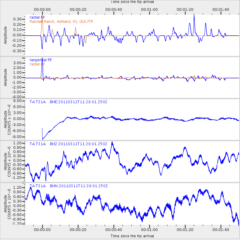
T31A Randall Ranch, Ashland, KS, USA - Earthquake Result Viewer
*The percent match for this event was below the threshold and hence no stack was calculated.
| Earthquake location: |
Near East Coast Of Honshu, Japan |
| Earthquake latitude/longitude: |
36.6/141.8 |
| Earthquake time(UTC): |
2011/03/11 (070) 11:16:50 GMT |
| Earthquake Depth: |
37 km |
| Earthquake Magnitude: |
5.5 MB |
| Earthquake Catalog/Contributor: |
WHDF/NEIC |
|
| Network: |
TA USArray Transportable Network (new EarthScope stations) |
| Station: |
T31A Randall Ranch, Ashland, KS, USA |
| Lat/Lon: |
37.10 N/99.68 W |
| Elevation: |
564 m |
|
| Distance: |
87.1 deg |
| Az: |
44.703 deg |
| Baz: |
314.949 deg |
| Ray Param: |
$rayparam |
*The percent match for this event was below the threshold and hence was not used in the summary stack. |
|
| Radial Match: |
47.665302 % |
| Radial Bump: |
398 |
| Transverse Match: |
60.951668 % |
| Transverse Bump: |
400 |
| SOD ConfigId: |
356183 |
| Insert Time: |
2011-08-14 23:34:51.669 +0000 |
| GWidth: |
2.5 |
| Max Bumps: |
400 |
| Tol: |
0.001 |
|
Signal To Noise
| Channel | StoN | STA | LTA |
| TA:T31A: :BHZ:20110311T11:29:01.250Z | 1.6587936 | 1.4783234E-6 | 8.9120397E-7 |
| TA:T31A: :BHN:20110311T11:29:01.250Z | 0.69686025 | 1.7615424E-6 | 2.5278273E-6 |
| TA:T31A: :BHE:20110311T11:29:01.250Z | 0.8564438 | 2.7951985E-6 | 3.2637265E-6 |
| Arrivals |
| Ps | |
| PpPs | |
| PsPs/PpSs | |


