You are here: Home > Network List > TA - USArray Transportable Network (new EarthScope stations) Stations List
> Station N59A State Game Land 141, Hazleton, PA, USA > Earthquake Result Viewer
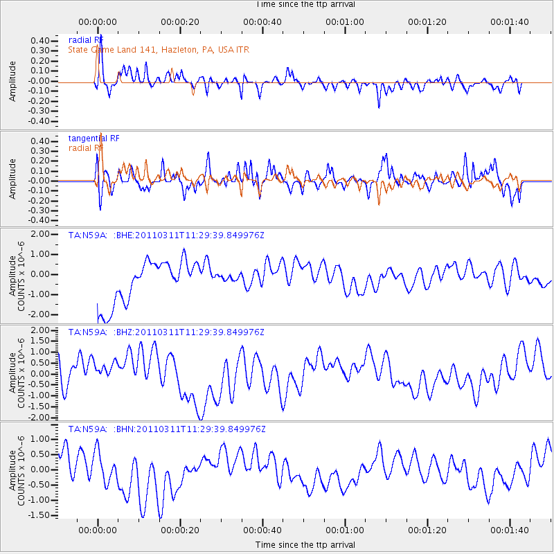
N59A State Game Land 141, Hazleton, PA, USA - Earthquake Result Viewer
*The percent match for this event was below the threshold and hence no stack was calculated.
| Earthquake location: |
Near East Coast Of Honshu, Japan |
| Earthquake latitude/longitude: |
36.6/141.8 |
| Earthquake time(UTC): |
2011/03/11 (070) 11:16:50 GMT |
| Earthquake Depth: |
37 km |
| Earthquake Magnitude: |
5.5 MB |
| Earthquake Catalog/Contributor: |
WHDF/NEIC |
|
| Network: |
TA USArray Transportable Network (new EarthScope stations) |
| Station: |
N59A State Game Land 141, Hazleton, PA, USA |
| Lat/Lon: |
40.92 N/75.77 W |
| Elevation: |
508 m |
|
| Distance: |
95.5 deg |
| Az: |
27.665 deg |
| Baz: |
330.472 deg |
| Ray Param: |
$rayparam |
*The percent match for this event was below the threshold and hence was not used in the summary stack. |
|
| Radial Match: |
69.26113 % |
| Radial Bump: |
400 |
| Transverse Match: |
36.496826 % |
| Transverse Bump: |
400 |
| SOD ConfigId: |
356183 |
| Insert Time: |
2011-08-15 00:29:58.179 +0000 |
| GWidth: |
2.5 |
| Max Bumps: |
400 |
| Tol: |
0.001 |
|
Signal To Noise
| Channel | StoN | STA | LTA |
| TA:N59A: :BHZ:20110311T11:29:39.849976Z | 1.0401028 | 6.752823E-7 | 6.4924575E-7 |
| TA:N59A: :BHN:20110311T11:29:39.849976Z | 0.68208325 | 5.0882244E-7 | 7.4598285E-7 |
| TA:N59A: :BHE:20110311T11:29:39.849976Z | 0.1925093 | 2.0290409E-7 | 1.0539964E-6 |
| Arrivals |
| Ps | |
| PpPs | |
| PsPs/PpSs | |


