You are here: Home > Network List > US - United States National Seismic Network Stations List
> Station HAWA Hanford, Washington, USA > Earthquake Result Viewer
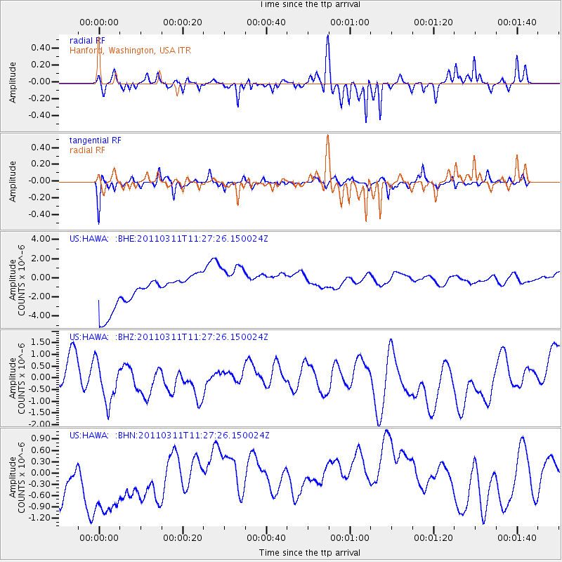
HAWA Hanford, Washington, USA - Earthquake Result Viewer
*The percent match for this event was below the threshold and hence no stack was calculated.
| Earthquake location: |
Near East Coast Of Honshu, Japan |
| Earthquake latitude/longitude: |
36.6/141.8 |
| Earthquake time(UTC): |
2011/03/11 (070) 11:16:50 GMT |
| Earthquake Depth: |
37 km |
| Earthquake Magnitude: |
5.5 MB |
| Earthquake Catalog/Contributor: |
WHDF/NEIC |
|
| Network: |
US United States National Seismic Network |
| Station: |
HAWA Hanford, Washington, USA |
| Lat/Lon: |
46.39 N/119.53 W |
| Elevation: |
364 m |
|
| Distance: |
69.8 deg |
| Az: |
46.802 deg |
| Baz: |
302.084 deg |
| Ray Param: |
$rayparam |
*The percent match for this event was below the threshold and hence was not used in the summary stack. |
|
| Radial Match: |
85.64979 % |
| Radial Bump: |
379 |
| Transverse Match: |
70.71015 % |
| Transverse Bump: |
334 |
| SOD ConfigId: |
356183 |
| Insert Time: |
2011-08-15 00:45:37.306 +0000 |
| GWidth: |
2.5 |
| Max Bumps: |
400 |
| Tol: |
0.001 |
|
Signal To Noise
| Channel | StoN | STA | LTA |
| US:HAWA: :BHZ:20110311T11:27:26.150024Z | 1.5538392 | 1.0092793E-6 | 6.495391E-7 |
| US:HAWA: :BHN:20110311T11:27:26.150024Z | 1.7854859 | 2.0423704E-6 | 1.1438736E-6 |
| US:HAWA: :BHE:20110311T11:27:26.150024Z | 1.439808 | 2.2848876E-6 | 1.5869391E-6 |
| Arrivals |
| Ps | |
| PpPs | |
| PsPs/PpSs | |


