You are here: Home > Network List > UW - Pacific Northwest Regional Seismic Network Stations List
> Station LEBA Lebam, WA, USA > Earthquake Result Viewer
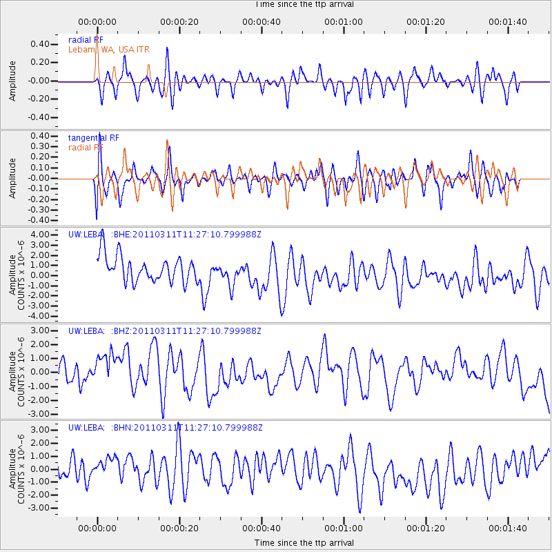
LEBA Lebam, WA, USA - Earthquake Result Viewer
*The percent match for this event was below the threshold and hence no stack was calculated.
| Earthquake location: |
Near East Coast Of Honshu, Japan |
| Earthquake latitude/longitude: |
36.6/141.8 |
| Earthquake time(UTC): |
2011/03/11 (070) 11:16:50 GMT |
| Earthquake Depth: |
37 km |
| Earthquake Magnitude: |
5.5 MB |
| Earthquake Catalog/Contributor: |
WHDF/NEIC |
|
| Network: |
UW Pacific Northwest Regional Seismic Network |
| Station: |
LEBA Lebam, WA, USA |
| Lat/Lon: |
46.55 N/123.56 W |
| Elevation: |
73 m |
|
| Distance: |
67.4 deg |
| Az: |
48.196 deg |
| Baz: |
299.68 deg |
| Ray Param: |
$rayparam |
*The percent match for this event was below the threshold and hence was not used in the summary stack. |
|
| Radial Match: |
41.921265 % |
| Radial Bump: |
400 |
| Transverse Match: |
49.740757 % |
| Transverse Bump: |
400 |
| SOD ConfigId: |
356183 |
| Insert Time: |
2011-08-15 00:56:01.294 +0000 |
| GWidth: |
2.5 |
| Max Bumps: |
400 |
| Tol: |
0.001 |
|
Signal To Noise
| Channel | StoN | STA | LTA |
| UW:LEBA: :BHZ:20110311T11:27:10.799988Z | 1.5745893 | 2.2682386E-6 | 1.4405272E-6 |
| UW:LEBA: :BHN:20110311T11:27:10.799988Z | 0.9685053 | 1.7359736E-6 | 1.7924253E-6 |
| UW:LEBA: :BHE:20110311T11:27:10.799988Z | 0.9124782 | 1.1646279E-6 | 1.276335E-6 |
| Arrivals |
| Ps | |
| PpPs | |
| PsPs/PpSs | |


