You are here: Home > Network List > AZ - ANZA Regional Network Stations List
> Station LVA2 AZ.LVA2 > Earthquake Result Viewer
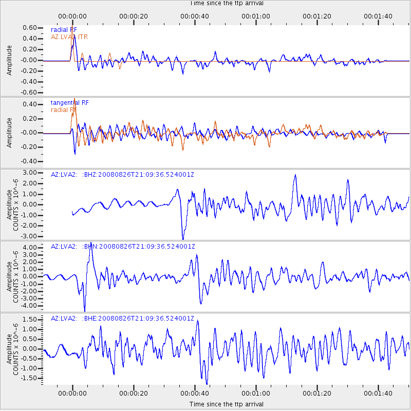
LVA2 AZ.LVA2 - Earthquake Result Viewer
*The percent match for this event was below the threshold and hence no stack was calculated.
| Earthquake location: |
Peru-Brazil Border Region |
| Earthquake latitude/longitude: |
-7.6/-74.4 |
| Earthquake time(UTC): |
2008/08/26 (239) 21:00:36 GMT |
| Earthquake Depth: |
154 km |
| Earthquake Magnitude: |
6.0 MB, 6.4 MW, 6.4 MW |
| Earthquake Catalog/Contributor: |
WHDF/NEIC |
|
| Network: |
AZ ANZA Regional Network |
| Station: |
LVA2 AZ.LVA2 |
| Lat/Lon: |
33.35 N/116.56 W |
| Elevation: |
1435 m |
|
| Distance: |
57.1 deg |
| Az: |
318.004 deg |
| Baz: |
127.593 deg |
| Ray Param: |
$rayparam |
*The percent match for this event was below the threshold and hence was not used in the summary stack. |
|
| Radial Match: |
78.71675 % |
| Radial Bump: |
400 |
| Transverse Match: |
76.383484 % |
| Transverse Bump: |
400 |
| SOD ConfigId: |
2504 |
| Insert Time: |
2010-02-26 19:57:10.344 +0000 |
| GWidth: |
2.5 |
| Max Bumps: |
400 |
| Tol: |
0.001 |
|
Signal To Noise
| Channel | StoN | STA | LTA |
| AZ:LVA2: :BHN:20080826T21:09:36.524001Z | 9.434717 | 1.7002174E-6 | 1.802086E-7 |
| AZ:LVA2: :BHE:20080826T21:09:36.524001Z | 1.2113206 | 4.356512E-7 | 3.5964976E-7 |
| AZ:LVA2: :BHZ:20080826T21:09:36.524001Z | 1.9063492 | 7.114263E-7 | 3.7318782E-7 |
| Arrivals |
| Ps | |
| PpPs | |
| PsPs/PpSs | |


