You are here: Home > Network List > TA - USArray Transportable Network (new EarthScope stations) Stations List
> Station H17A Grant Village (NPS), Yellowstone Nt. Park, WY, USA > Earthquake Result Viewer
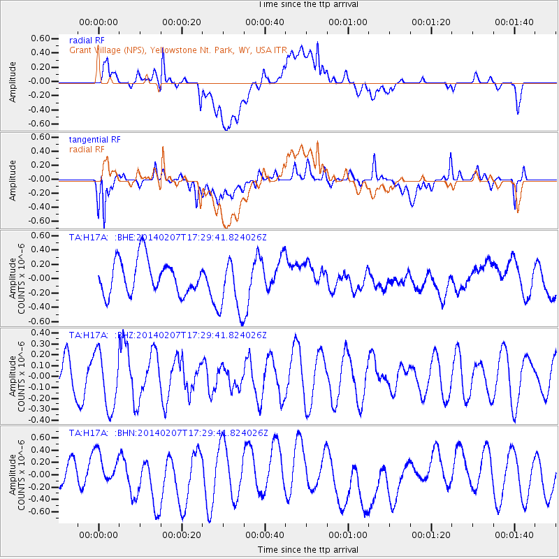
H17A Grant Village (NPS), Yellowstone Nt. Park, WY, USA - Earthquake Result Viewer
*The percent match for this event was below the threshold and hence no stack was calculated.
| Earthquake location: |
Near East Coast Of Honshu, Japan |
| Earthquake latitude/longitude: |
37.5/141.4 |
| Earthquake time(UTC): |
2014/02/07 (038) 17:18:33 GMT |
| Earthquake Depth: |
57 km |
| Earthquake Magnitude: |
5.0 MW |
| Earthquake Catalog/Contributor: |
ISC/ISC |
|
| Network: |
TA USArray Transportable Network (new EarthScope stations) |
| Station: |
H17A Grant Village (NPS), Yellowstone Nt. Park, WY, USA |
| Lat/Lon: |
44.40 N/110.58 W |
| Elevation: |
2400 m |
|
| Distance: |
75.7 deg |
| Az: |
44.723 deg |
| Baz: |
308.722 deg |
| Ray Param: |
$rayparam |
*The percent match for this event was below the threshold and hence was not used in the summary stack. |
|
| Radial Match: |
47.23752 % |
| Radial Bump: |
400 |
| Transverse Match: |
51.904354 % |
| Transverse Bump: |
400 |
| SOD ConfigId: |
3390531 |
| Insert Time: |
2019-04-10 06:37:38.773 +0000 |
| GWidth: |
2.5 |
| Max Bumps: |
400 |
| Tol: |
0.001 |
|
Signal To Noise
| Channel | StoN | STA | LTA |
| TA:H17A: :BHZ:20140207T17:29:41.824026Z | 1.7509274 | 2.6522284E-7 | 1.5147562E-7 |
| TA:H17A: :BHN:20140207T17:29:41.824026Z | 1.7765499 | 2.983285E-7 | 1.6792575E-7 |
| TA:H17A: :BHE:20140207T17:29:41.824026Z | 1.6350516 | 3.84305E-7 | 2.3504151E-7 |
| Arrivals |
| Ps | |
| PpPs | |
| PsPs/PpSs | |


