You are here: Home > Network List > TA - USArray Transportable Network (new EarthScope stations) Stations List
> Station R58B Mineral, VA, USA > Earthquake Result Viewer
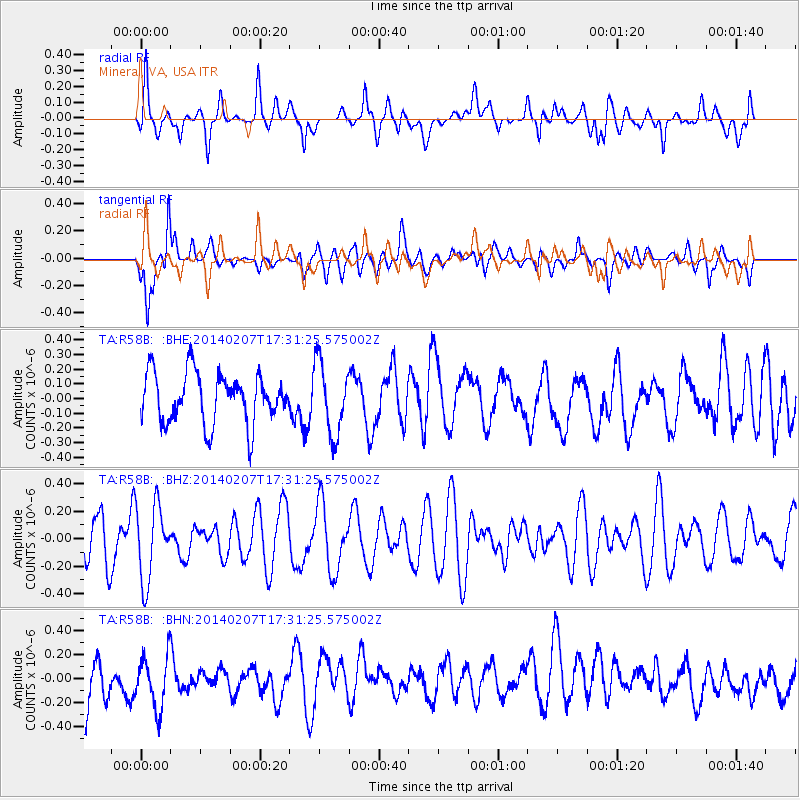
R58B Mineral, VA, USA - Earthquake Result Viewer
*The percent match for this event was below the threshold and hence no stack was calculated.
| Earthquake location: |
Near East Coast Of Honshu, Japan |
| Earthquake latitude/longitude: |
37.5/141.4 |
| Earthquake time(UTC): |
2014/02/07 (038) 17:18:33 GMT |
| Earthquake Depth: |
57 km |
| Earthquake Magnitude: |
5.0 MW |
| Earthquake Catalog/Contributor: |
ISC/ISC |
|
| Network: |
TA USArray Transportable Network (new EarthScope stations) |
| Station: |
R58B Mineral, VA, USA |
| Lat/Lon: |
37.96 N/77.88 W |
| Elevation: |
116 m |
|
| Distance: |
96.6 deg |
| Az: |
30.272 deg |
| Baz: |
329.54 deg |
| Ray Param: |
$rayparam |
*The percent match for this event was below the threshold and hence was not used in the summary stack. |
|
| Radial Match: |
59.788338 % |
| Radial Bump: |
400 |
| Transverse Match: |
62.131985 % |
| Transverse Bump: |
400 |
| SOD ConfigId: |
3390531 |
| Insert Time: |
2019-04-10 06:38:18.738 +0000 |
| GWidth: |
2.5 |
| Max Bumps: |
400 |
| Tol: |
0.001 |
|
Signal To Noise
| Channel | StoN | STA | LTA |
| TA:R58B: :BHZ:20140207T17:31:25.575002Z | 1.2366742 | 2.752383E-7 | 2.2256332E-7 |
| TA:R58B: :BHN:20140207T17:31:25.575002Z | 1.1232468 | 2.3487884E-7 | 2.0910706E-7 |
| TA:R58B: :BHE:20140207T17:31:25.575002Z | 1.438335 | 2.4666434E-7 | 1.7149297E-7 |
| Arrivals |
| Ps | |
| PpPs | |
| PsPs/PpSs | |


