You are here: Home > Network List > US - United States National Seismic Network Stations List
> Station AMTX Amarillo, Texas, USA > Earthquake Result Viewer
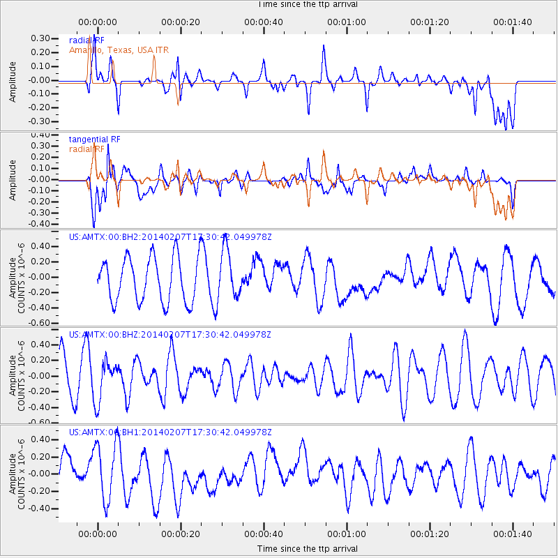
AMTX Amarillo, Texas, USA - Earthquake Result Viewer
*The percent match for this event was below the threshold and hence no stack was calculated.
| Earthquake location: |
Near East Coast Of Honshu, Japan |
| Earthquake latitude/longitude: |
37.5/141.4 |
| Earthquake time(UTC): |
2014/02/07 (038) 17:18:33 GMT |
| Earthquake Depth: |
57 km |
| Earthquake Magnitude: |
5.0 MW |
| Earthquake Catalog/Contributor: |
ISC/ISC |
|
| Network: |
US United States National Seismic Network |
| Station: |
AMTX Amarillo, Texas, USA |
| Lat/Lon: |
34.53 N/101.41 W |
| Elevation: |
1010 m |
|
| Distance: |
87.5 deg |
| Az: |
47.331 deg |
| Baz: |
314.937 deg |
| Ray Param: |
$rayparam |
*The percent match for this event was below the threshold and hence was not used in the summary stack. |
|
| Radial Match: |
41.377094 % |
| Radial Bump: |
400 |
| Transverse Match: |
58.829403 % |
| Transverse Bump: |
400 |
| SOD ConfigId: |
3390531 |
| Insert Time: |
2019-04-10 06:38:52.846 +0000 |
| GWidth: |
2.5 |
| Max Bumps: |
400 |
| Tol: |
0.001 |
|
Signal To Noise
| Channel | StoN | STA | LTA |
| US:AMTX:00:BHZ:20140207T17:30:42.049978Z | 0.9562047 | 2.5956325E-7 | 2.7145154E-7 |
| US:AMTX:00:BH1:20140207T17:30:42.049978Z | 2.0385752 | 3.3834328E-7 | 1.6597048E-7 |
| US:AMTX:00:BH2:20140207T17:30:42.049978Z | 0.7408031 | 2.2501835E-7 | 3.037492E-7 |
| Arrivals |
| Ps | |
| PpPs | |
| PsPs/PpSs | |


