You are here: Home > Network List > AZ - ANZA Regional Network Stations List
> Station LVA2 AZ.LVA2 > Earthquake Result Viewer
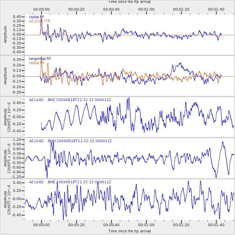
LVA2 AZ.LVA2 - Earthquake Result Viewer
*The percent match for this event was below the threshold and hence no stack was calculated.
| Earthquake location: |
South Of Fiji Islands |
| Earthquake latitude/longitude: |
-26.1/-178.4 |
| Earthquake time(UTC): |
2009/08/18 (230) 21:20:47 GMT |
| Earthquake Depth: |
270 km |
| Earthquake Magnitude: |
5.5 MB, 6.3 MW, 6.3 MW |
| Earthquake Catalog/Contributor: |
WHDF/NEIC |
|
| Network: |
AZ ANZA Regional Network |
| Station: |
LVA2 AZ.LVA2 |
| Lat/Lon: |
33.35 N/116.56 W |
| Elevation: |
1435 m |
|
| Distance: |
83.3 deg |
| Az: |
47.979 deg |
| Baz: |
232.971 deg |
| Ray Param: |
$rayparam |
*The percent match for this event was below the threshold and hence was not used in the summary stack. |
|
| Radial Match: |
47.396824 % |
| Radial Bump: |
400 |
| Transverse Match: |
30.760447 % |
| Transverse Bump: |
400 |
| SOD ConfigId: |
2622 |
| Insert Time: |
2010-02-26 19:57:36.180 +0000 |
| GWidth: |
2.5 |
| Max Bumps: |
400 |
| Tol: |
0.001 |
|
Signal To Noise
| Channel | StoN | STA | LTA |
| AZ:LVA2: :BHN:20090818T21:32:13.099011Z | 4.5468936 | 4.194001E-7 | 9.2238814E-8 |
| AZ:LVA2: :BHE:20090818T21:32:13.099011Z | 0.9251361 | 2.774871E-7 | 2.9994192E-7 |
| AZ:LVA2: :BHZ:20090818T21:32:13.099011Z | 1.081936 | 2.1045057E-7 | 1.9451296E-7 |
| Arrivals |
| Ps | |
| PpPs | |
| PsPs/PpSs | |


