You are here: Home > Network List > US - United States National Seismic Network Stations List
> Station HLID Hailey, Idaho, USA > Earthquake Result Viewer
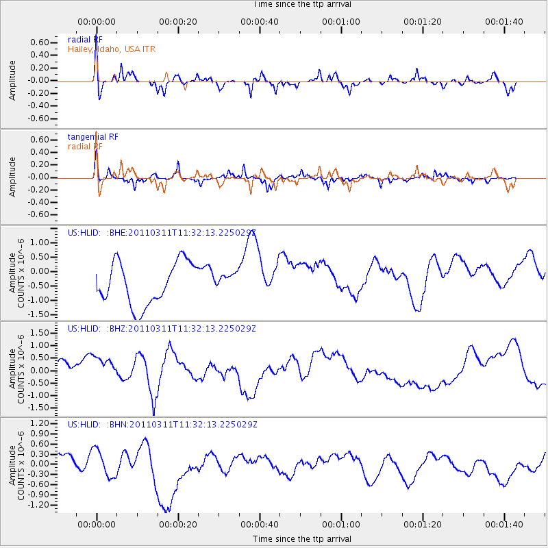
HLID Hailey, Idaho, USA - Earthquake Result Viewer
*The percent match for this event was below the threshold and hence no stack was calculated.
| Earthquake location: |
Near East Coast Of Honshu, Japan |
| Earthquake latitude/longitude: |
35.7/140.9 |
| Earthquake time(UTC): |
2011/03/11 (070) 11:21:03 GMT |
| Earthquake Depth: |
35 km |
| Earthquake Magnitude: |
5.7 MB |
| Earthquake Catalog/Contributor: |
WHDF/NEIC |
|
| Network: |
US United States National Seismic Network |
| Station: |
HLID Hailey, Idaho, USA |
| Lat/Lon: |
43.56 N/114.41 W |
| Elevation: |
1772 m |
|
| Distance: |
75.6 deg |
| Az: |
46.567 deg |
| Baz: |
305.585 deg |
| Ray Param: |
$rayparam |
*The percent match for this event was below the threshold and hence was not used in the summary stack. |
|
| Radial Match: |
80.75767 % |
| Radial Bump: |
400 |
| Transverse Match: |
63.345333 % |
| Transverse Bump: |
259 |
| SOD ConfigId: |
356183 |
| Insert Time: |
2011-08-15 03:17:32.398 +0000 |
| GWidth: |
2.5 |
| Max Bumps: |
400 |
| Tol: |
0.001 |
|
Signal To Noise
| Channel | StoN | STA | LTA |
| US:HLID: :BHZ:20110311T11:32:13.225029Z | 1.316753 | 1.1131824E-6 | 8.4539954E-7 |
| US:HLID: :BHN:20110311T11:32:13.225029Z | 1.3972003 | 4.4811563E-7 | 3.2072396E-7 |
| US:HLID: :BHE:20110311T11:32:13.225029Z | 0.38874823 | 2.8782313E-7 | 7.4038445E-7 |
| Arrivals |
| Ps | |
| PpPs | |
| PsPs/PpSs | |


