You are here: Home > Network List > TA - USArray Transportable Network (new EarthScope stations) Stations List
> Station G05D Wamic, OR, USA > Earthquake Result Viewer
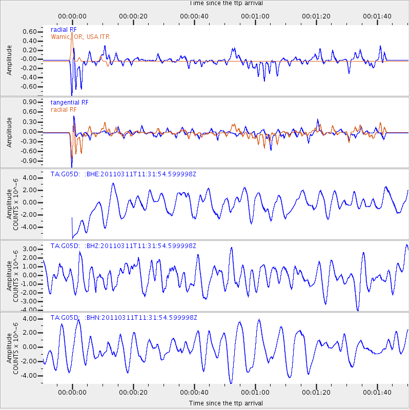
G05D Wamic, OR, USA - Earthquake Result Viewer
*The percent match for this event was below the threshold and hence no stack was calculated.
| Earthquake location: |
Off East Coast Of Honshu, Japan |
| Earthquake latitude/longitude: |
37.5/143.1 |
| Earthquake time(UTC): |
2011/03/11 (070) 11:21:29 GMT |
| Earthquake Depth: |
35 km |
| Earthquake Magnitude: |
5.8 MB |
| Earthquake Catalog/Contributor: |
WHDF/NEIC |
|
| Network: |
TA USArray Transportable Network (new EarthScope stations) |
| Station: |
G05D Wamic, OR, USA |
| Lat/Lon: |
45.24 N/121.32 W |
| Elevation: |
592 m |
|
| Distance: |
68.0 deg |
| Az: |
49.316 deg |
| Baz: |
301.446 deg |
| Ray Param: |
$rayparam |
*The percent match for this event was below the threshold and hence was not used in the summary stack. |
|
| Radial Match: |
68.166145 % |
| Radial Bump: |
332 |
| Transverse Match: |
58.79984 % |
| Transverse Bump: |
400 |
| SOD ConfigId: |
356183 |
| Insert Time: |
2011-08-15 04:51:33.495 +0000 |
| GWidth: |
2.5 |
| Max Bumps: |
400 |
| Tol: |
0.001 |
|
Signal To Noise
| Channel | StoN | STA | LTA |
| TA:G05D: :BHZ:20110311T11:31:54.599998Z | 1.2370994 | 1.5369691E-6 | 1.2423974E-6 |
| TA:G05D: :BHN:20110311T11:31:54.599998Z | 1.17686 | 2.8200395E-6 | 2.3962405E-6 |
| TA:G05D: :BHE:20110311T11:31:54.599998Z | 0.82085 | 1.7295246E-6 | 2.1069923E-6 |
| Arrivals |
| Ps | |
| PpPs | |
| PsPs/PpSs | |


