You are here: Home > Network List > AZ - ANZA Regional Network Stations List
> Station MONP AZ.MONP > Earthquake Result Viewer
MONP AZ.MONP - Earthquake Result Viewer

| Earthquake location: |
Near Coast Of Peru |
| Earthquake latitude/longitude: |
-17.4/-72.2 |
| Earthquake time(UTC): |
2001/06/23 (174) 20:56:07 GMT |
| Earthquake Depth: |
33 km |
| Earthquake Magnitude: |
5.8 MB |
| Earthquake Catalog/Contributor: |
WHDF/NEIC |
|
| Network: |
AZ ANZA Regional Network |
| Station: |
MONP AZ.MONP |
| Lat/Lon: |
32.89 N/116.42 W |
| Elevation: |
1920 m |
|
| Distance: |
65.5 deg |
| Az: |
319.815 deg |
| Baz: |
132.922 deg |
| Ray Param: |
0.058179162 |
| Estimated Moho Depth: |
12.0 km |
| Estimated Crust Vp/Vs: |
1.61 |
| Assumed Crust Vp: |
6.264 km/s |
| Estimated Crust Vs: |
3.897 km/s |
| Estimated Crust Poisson's Ratio: |
0.18 |
|
| Radial Match: |
97.194916 % |
| Radial Bump: |
356 |
| Transverse Match: |
78.288475 % |
| Transverse Bump: |
400 |
| SOD ConfigId: |
3753 |
| Insert Time: |
2010-02-26 19:58:04.253 +0000 |
| GWidth: |
2.5 |
| Max Bumps: |
400 |
| Tol: |
0.001 |
|
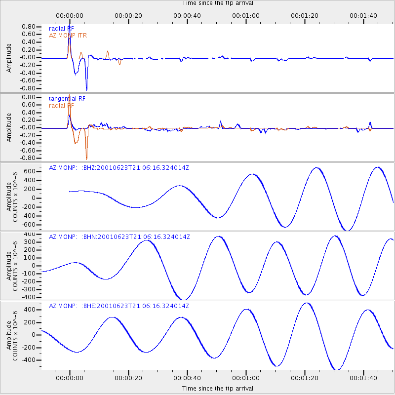
Signal To Noise
| Channel | StoN | STA | LTA |
| AZ:MONP: :BHN:20010623T21:06:16.324014Z | 0.7370228 | 3.6996444E-5 | 5.0197148E-5 |
| AZ:MONP: :BHE:20010623T21:06:16.324014Z | 2.45472 | 2.9094415E-4 | 1.18524375E-4 |
| AZ:MONP: :BHZ:20010623T21:06:16.324014Z | 0.76943284 | 1.1261755E-4 | 1.4636437E-4 |
| Arrivals |
| Ps | 1.2 SECOND |
| PpPs | 4.8 SECOND |
| PsPs/PpSs | 6.0 SECOND |


