You are here: Home > Network List > TA - USArray Transportable Network (new EarthScope stations) Stations List
> Station A31A Linda, St. Vincent, MN, USA > Earthquake Result Viewer
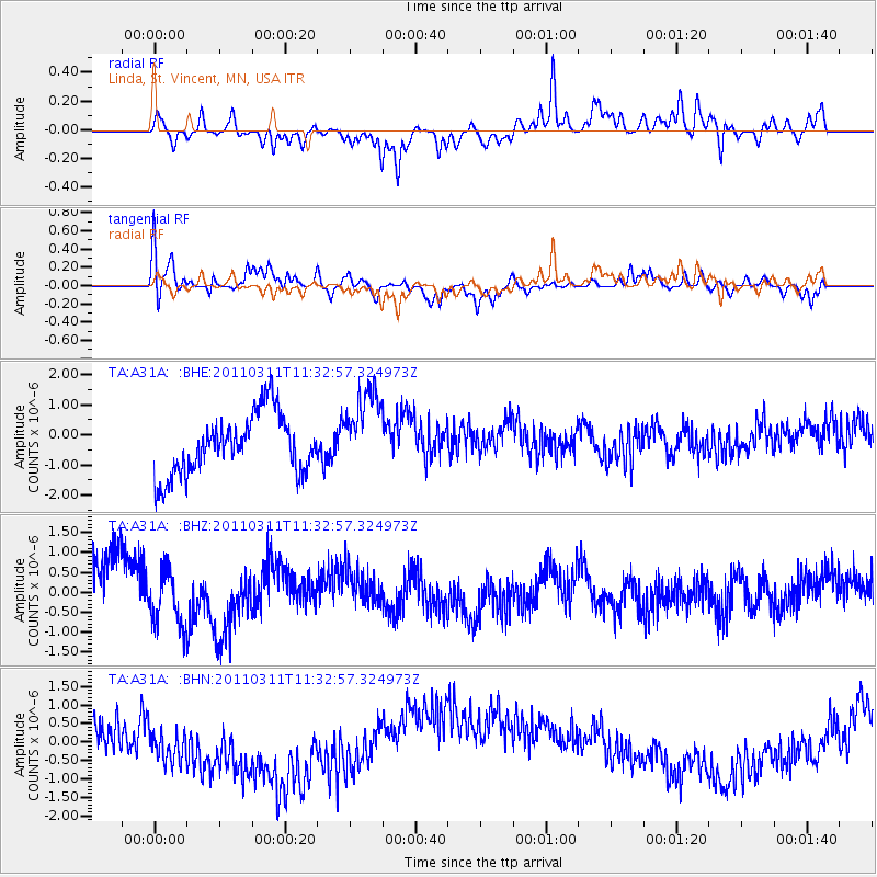
A31A Linda, St. Vincent, MN, USA - Earthquake Result Viewer
*The percent match for this event was below the threshold and hence no stack was calculated.
| Earthquake location: |
Off East Coast Of Honshu, Japan |
| Earthquake latitude/longitude: |
37.5/143.1 |
| Earthquake time(UTC): |
2011/03/11 (070) 11:21:29 GMT |
| Earthquake Depth: |
35 km |
| Earthquake Magnitude: |
5.8 MB |
| Earthquake Catalog/Contributor: |
WHDF/NEIC |
|
| Network: |
TA USArray Transportable Network (new EarthScope stations) |
| Station: |
A31A Linda, St. Vincent, MN, USA |
| Lat/Lon: |
48.93 N/97.19 W |
| Elevation: |
244 m |
|
| Distance: |
78.7 deg |
| Az: |
35.729 deg |
| Baz: |
315.265 deg |
| Ray Param: |
$rayparam |
*The percent match for this event was below the threshold and hence was not used in the summary stack. |
|
| Radial Match: |
21.364567 % |
| Radial Bump: |
272 |
| Transverse Match: |
49.745186 % |
| Transverse Bump: |
400 |
| SOD ConfigId: |
356183 |
| Insert Time: |
2011-08-15 05:18:02.042 +0000 |
| GWidth: |
2.5 |
| Max Bumps: |
400 |
| Tol: |
0.001 |
|
Signal To Noise
| Channel | StoN | STA | LTA |
| TA:A31A: :BHZ:20110311T11:32:57.324973Z | 1.0623618 | 6.930474E-7 | 6.5236475E-7 |
| TA:A31A: :BHN:20110311T11:32:57.324973Z | 2.0467339 | 8.6643513E-7 | 4.2332576E-7 |
| TA:A31A: :BHE:20110311T11:32:57.324973Z | 1.3846399 | 1.3629682E-6 | 9.843485E-7 |
| Arrivals |
| Ps | |
| PpPs | |
| PsPs/PpSs | |


