You are here: Home > Network List > TA - USArray Transportable Network (new EarthScope stations) Stations List
> Station J36A Seneca 1, Swea City, IA, USA > Earthquake Result Viewer
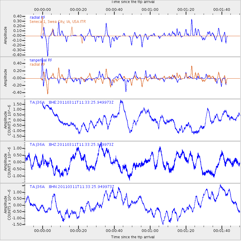
J36A Seneca 1, Swea City, IA, USA - Earthquake Result Viewer
*The percent match for this event was below the threshold and hence no stack was calculated.
| Earthquake location: |
Off East Coast Of Honshu, Japan |
| Earthquake latitude/longitude: |
37.5/143.1 |
| Earthquake time(UTC): |
2011/03/11 (070) 11:21:29 GMT |
| Earthquake Depth: |
35 km |
| Earthquake Magnitude: |
5.8 MB |
| Earthquake Catalog/Contributor: |
WHDF/NEIC |
|
| Network: |
TA USArray Transportable Network (new EarthScope stations) |
| Station: |
J36A Seneca 1, Swea City, IA, USA |
| Lat/Lon: |
43.33 N/94.34 W |
| Elevation: |
370 m |
|
| Distance: |
84.1 deg |
| Az: |
38.177 deg |
| Baz: |
317.682 deg |
| Ray Param: |
$rayparam |
*The percent match for this event was below the threshold and hence was not used in the summary stack. |
|
| Radial Match: |
26.369547 % |
| Radial Bump: |
250 |
| Transverse Match: |
39.720745 % |
| Transverse Bump: |
235 |
| SOD ConfigId: |
356183 |
| Insert Time: |
2011-08-15 05:21:14.740 +0000 |
| GWidth: |
2.5 |
| Max Bumps: |
400 |
| Tol: |
0.001 |
|
Signal To Noise
| Channel | StoN | STA | LTA |
| TA:J36A: :BHZ:20110311T11:33:25.949973Z | 0.43173718 | 3.609287E-7 | 8.3599167E-7 |
| TA:J36A: :BHN:20110311T11:33:25.949973Z | 1.8459233 | 8.79115E-7 | 4.7624678E-7 |
| TA:J36A: :BHE:20110311T11:33:25.949973Z | 0.44750822 | 3.4638188E-7 | 7.740235E-7 |
| Arrivals |
| Ps | |
| PpPs | |
| PsPs/PpSs | |


