You are here: Home > Network List > US - United States National Seismic Network Stations List
> Station HAWA Hanford, Washington, USA > Earthquake Result Viewer
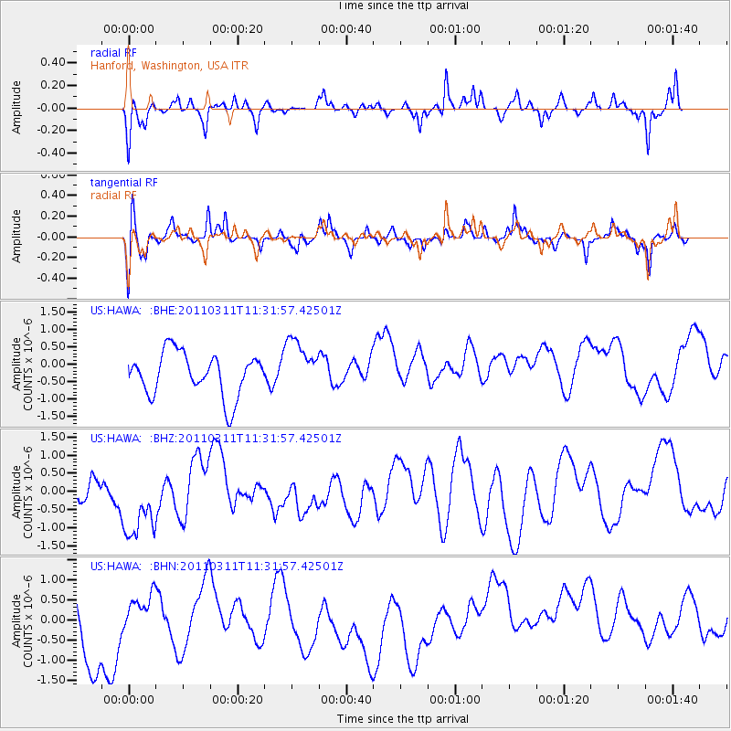
HAWA Hanford, Washington, USA - Earthquake Result Viewer
*The percent match for this event was below the threshold and hence no stack was calculated.
| Earthquake location: |
Off East Coast Of Honshu, Japan |
| Earthquake latitude/longitude: |
37.5/143.1 |
| Earthquake time(UTC): |
2011/03/11 (070) 11:21:29 GMT |
| Earthquake Depth: |
35 km |
| Earthquake Magnitude: |
5.8 MB |
| Earthquake Catalog/Contributor: |
WHDF/NEIC |
|
| Network: |
US United States National Seismic Network |
| Station: |
HAWA Hanford, Washington, USA |
| Lat/Lon: |
46.39 N/119.53 W |
| Elevation: |
364 m |
|
| Distance: |
68.5 deg |
| Az: |
47.556 deg |
| Baz: |
302.069 deg |
| Ray Param: |
$rayparam |
*The percent match for this event was below the threshold and hence was not used in the summary stack. |
|
| Radial Match: |
55.09618 % |
| Radial Bump: |
392 |
| Transverse Match: |
52.193127 % |
| Transverse Bump: |
322 |
| SOD ConfigId: |
356183 |
| Insert Time: |
2011-08-15 05:36:48.913 +0000 |
| GWidth: |
2.5 |
| Max Bumps: |
400 |
| Tol: |
0.001 |
|
Signal To Noise
| Channel | StoN | STA | LTA |
| US:HAWA: :BHZ:20110311T11:31:57.42501Z | 1.993753 | 1.3228154E-6 | 6.634801E-7 |
| US:HAWA: :BHN:20110311T11:31:57.42501Z | 0.27200028 | 3.765849E-7 | 1.3845018E-6 |
| US:HAWA: :BHE:20110311T11:31:57.42501Z | 1.2347519 | 7.533063E-7 | 6.1008717E-7 |
| Arrivals |
| Ps | |
| PpPs | |
| PsPs/PpSs | |


