You are here: Home > Network List > US - United States National Seismic Network Stations List
> Station AMTX Amarillo, Texas, USA > Earthquake Result Viewer
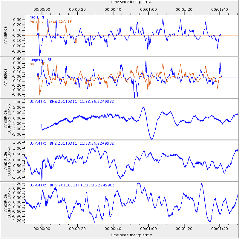
AMTX Amarillo, Texas, USA - Earthquake Result Viewer
*The percent match for this event was below the threshold and hence no stack was calculated.
| Earthquake location: |
Off East Coast Of Honshu, Japan |
| Earthquake latitude/longitude: |
37.5/143.1 |
| Earthquake time(UTC): |
2011/03/11 (070) 11:21:29 GMT |
| Earthquake Depth: |
35 km |
| Earthquake Magnitude: |
5.8 MB |
| Earthquake Catalog/Contributor: |
WHDF/NEIC |
|
| Network: |
US United States National Seismic Network |
| Station: |
AMTX Amarillo, Texas, USA |
| Lat/Lon: |
34.53 N/101.41 W |
| Elevation: |
1010 m |
|
| Distance: |
86.6 deg |
| Az: |
48.279 deg |
| Baz: |
314.063 deg |
| Ray Param: |
$rayparam |
*The percent match for this event was below the threshold and hence was not used in the summary stack. |
|
| Radial Match: |
46.100002 % |
| Radial Bump: |
338 |
| Transverse Match: |
54.97924 % |
| Transverse Bump: |
311 |
| SOD ConfigId: |
356183 |
| Insert Time: |
2011-08-15 05:38:31.248 +0000 |
| GWidth: |
2.5 |
| Max Bumps: |
400 |
| Tol: |
0.001 |
|
Signal To Noise
| Channel | StoN | STA | LTA |
| US:AMTX: :BHZ:20110311T11:33:36.224998Z | 1.1329087 | 6.098977E-7 | 5.383468E-7 |
| US:AMTX: :BHN:20110311T11:33:36.224998Z | 0.807027 | 2.9501598E-7 | 3.6555903E-7 |
| US:AMTX: :BHE:20110311T11:33:36.224998Z | 1.2723639 | 8.406698E-7 | 6.6071493E-7 |
| Arrivals |
| Ps | |
| PpPs | |
| PsPs/PpSs | |


