
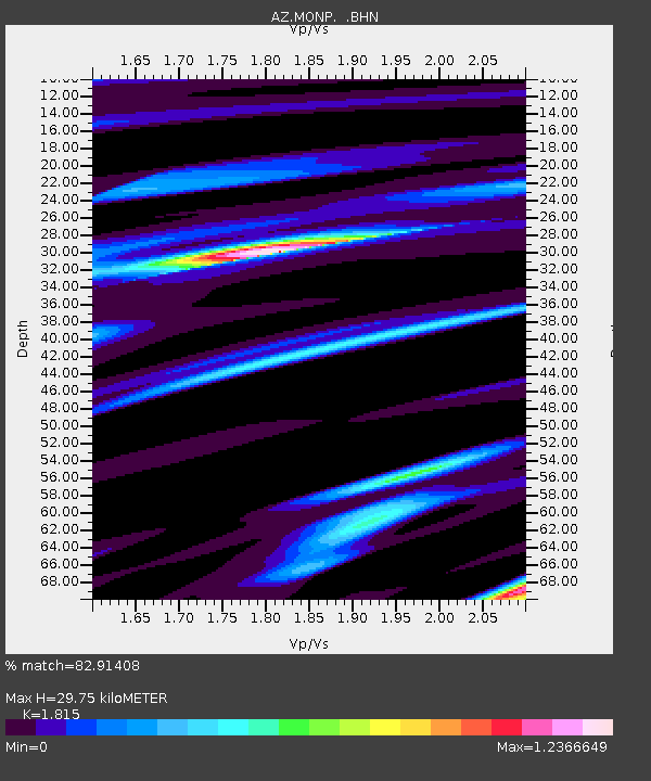
MONP AZ.MONP - Earthquake Result Viewer
| ||||||||||||||||||
| ||||||||||||||||||
| ||||||||||||||||||
|
Signal To Noise
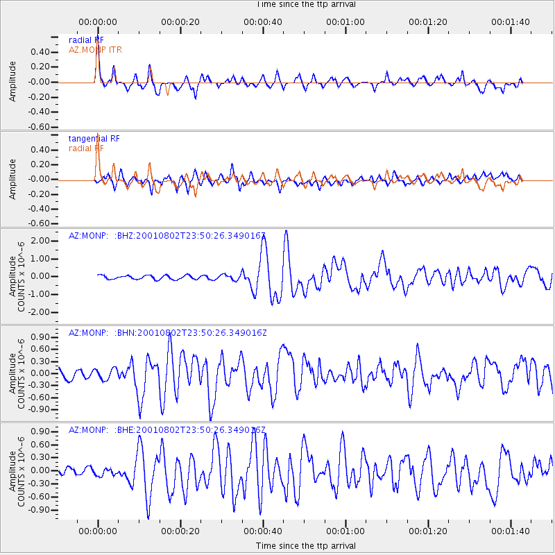
| Channel | StoN | STA | LTA |
| AZ:MONP: :BHN:20010802T23:50:26.349016Z | 1.1628672 | 1.4220721E-7 | 1.2229015E-7 |
| AZ:MONP: :BHE:20010802T23:50:26.349016Z | 1.3704059 | 1.7017557E-7 | 1.2417895E-7 |
| AZ:MONP: :BHZ:20010802T23:50:26.349016Z | 1.4417151 | 1.5654537E-7 | 1.0858273E-7 |
| Arrivals | |
| Ps | 4.1 SECOND |
| PpPs | 13 SECOND |
| PsPs/PpSs | 17 SECOND |

