You are here: Home > Network List > TA - USArray Transportable Network (new EarthScope stations) Stations List
> Station R29A Marienthal, KS, USA > Earthquake Result Viewer
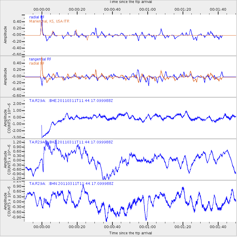
R29A Marienthal, KS, USA - Earthquake Result Viewer
*The percent match for this event was below the threshold and hence no stack was calculated.
| Earthquake location: |
Off East Coast Of Honshu, Japan |
| Earthquake latitude/longitude: |
36.2/142.4 |
| Earthquake time(UTC): |
2011/03/11 (070) 11:32:14 GMT |
| Earthquake Depth: |
35 km |
| Earthquake Magnitude: |
5.7 MB |
| Earthquake Catalog/Contributor: |
WHDF/NEIC |
|
| Network: |
TA USArray Transportable Network (new EarthScope stations) |
| Station: |
R29A Marienthal, KS, USA |
| Lat/Lon: |
38.42 N/101.14 W |
| Elevation: |
957 m |
|
| Distance: |
85.3 deg |
| Az: |
44.868 deg |
| Baz: |
313.437 deg |
| Ray Param: |
$rayparam |
*The percent match for this event was below the threshold and hence was not used in the summary stack. |
|
| Radial Match: |
51.482735 % |
| Radial Bump: |
400 |
| Transverse Match: |
64.995605 % |
| Transverse Bump: |
400 |
| SOD ConfigId: |
356183 |
| Insert Time: |
2011-08-15 06:52:04.992 +0000 |
| GWidth: |
2.5 |
| Max Bumps: |
400 |
| Tol: |
0.001 |
|
Signal To Noise
| Channel | StoN | STA | LTA |
| TA:R29A: :BHZ:20110311T11:44:17.099988Z | 2.5717778 | 1.6239337E-6 | 6.31444E-7 |
| TA:R29A: :BHN:20110311T11:44:17.099988Z | 0.48183063 | 2.1029237E-7 | 4.3644457E-7 |
| TA:R29A: :BHE:20110311T11:44:17.099988Z | 0.94311404 | 9.008931E-7 | 9.552324E-7 |
| Arrivals |
| Ps | |
| PpPs | |
| PsPs/PpSs | |


