You are here: Home > Network List > TA - USArray Transportable Network (new EarthScope stations) Stations List
> Station Z39A Irene McRaven, Queen City, TX, USA > Earthquake Result Viewer
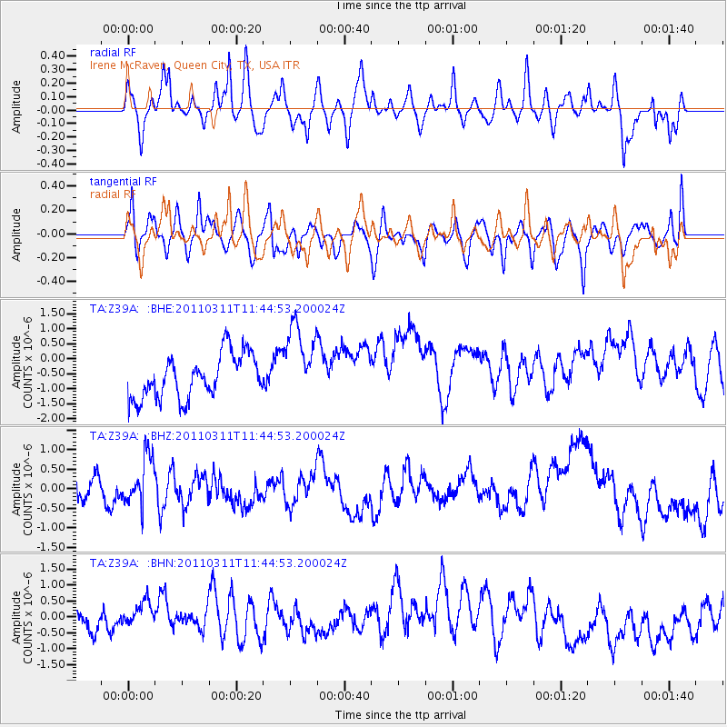
Z39A Irene McRaven, Queen City, TX, USA - Earthquake Result Viewer
*The percent match for this event was below the threshold and hence no stack was calculated.
| Earthquake location: |
Off East Coast Of Honshu, Japan |
| Earthquake latitude/longitude: |
36.2/142.4 |
| Earthquake time(UTC): |
2011/03/11 (070) 11:32:14 GMT |
| Earthquake Depth: |
35 km |
| Earthquake Magnitude: |
5.7 MB |
| Earthquake Catalog/Contributor: |
WHDF/NEIC |
|
| Network: |
TA USArray Transportable Network (new EarthScope stations) |
| Station: |
Z39A Irene McRaven, Queen City, TX, USA |
| Lat/Lon: |
33.24 N/94.18 W |
| Elevation: |
112 m |
|
| Distance: |
93.0 deg |
| Az: |
44.46 deg |
| Baz: |
317.493 deg |
| Ray Param: |
$rayparam |
*The percent match for this event was below the threshold and hence was not used in the summary stack. |
|
| Radial Match: |
64.37251 % |
| Radial Bump: |
400 |
| Transverse Match: |
59.09419 % |
| Transverse Bump: |
400 |
| SOD ConfigId: |
356183 |
| Insert Time: |
2011-08-15 07:19:24.040 +0000 |
| GWidth: |
2.5 |
| Max Bumps: |
400 |
| Tol: |
0.001 |
|
Signal To Noise
| Channel | StoN | STA | LTA |
| TA:Z39A: :BHZ:20110311T11:44:53.200024Z | 1.5651121 | 6.101442E-7 | 3.8984058E-7 |
| TA:Z39A: :BHN:20110311T11:44:53.200024Z | 0.77651423 | 4.1851476E-7 | 5.38966E-7 |
| TA:Z39A: :BHE:20110311T11:44:53.200024Z | 1.7976128 | 1.3142425E-6 | 7.311043E-7 |
| Arrivals |
| Ps | |
| PpPs | |
| PsPs/PpSs | |


