You are here: Home > Network List > TA - USArray Transportable Network (new EarthScope stations) Stations List
> Station H34A Spellman Lake, Hanley Falls, MN, USA > Earthquake Result Viewer
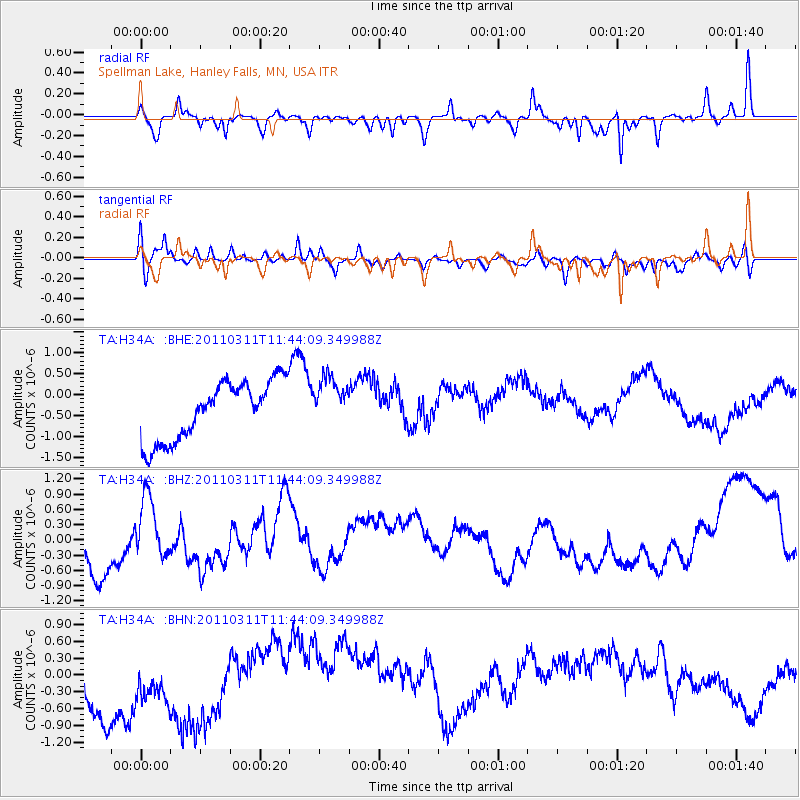
H34A Spellman Lake, Hanley Falls, MN, USA - Earthquake Result Viewer
*The percent match for this event was below the threshold and hence no stack was calculated.
| Earthquake location: |
Off East Coast Of Honshu, Japan |
| Earthquake latitude/longitude: |
36.2/142.4 |
| Earthquake time(UTC): |
2011/03/11 (070) 11:32:14 GMT |
| Earthquake Depth: |
35 km |
| Earthquake Magnitude: |
5.7 MB |
| Earthquake Catalog/Contributor: |
WHDF/NEIC |
|
| Network: |
TA USArray Transportable Network (new EarthScope stations) |
| Station: |
H34A Spellman Lake, Hanley Falls, MN, USA |
| Lat/Lon: |
44.67 N/95.78 W |
| Elevation: |
329 m |
|
| Distance: |
83.8 deg |
| Az: |
37.578 deg |
| Baz: |
316.295 deg |
| Ray Param: |
$rayparam |
*The percent match for this event was below the threshold and hence was not used in the summary stack. |
|
| Radial Match: |
55.24427 % |
| Radial Bump: |
278 |
| Transverse Match: |
42.649162 % |
| Transverse Bump: |
400 |
| SOD ConfigId: |
356183 |
| Insert Time: |
2011-08-15 07:28:13.878 +0000 |
| GWidth: |
2.5 |
| Max Bumps: |
400 |
| Tol: |
0.001 |
|
Signal To Noise
| Channel | StoN | STA | LTA |
| TA:H34A: :BHZ:20110311T11:44:09.349988Z | 1.8905632 | 6.853269E-7 | 3.6249878E-7 |
| TA:H34A: :BHN:20110311T11:44:09.349988Z | 1.0607862 | 9.951509E-7 | 9.3812577E-7 |
| TA:H34A: :BHE:20110311T11:44:09.349988Z | 0.8616961 | 5.999655E-7 | 6.962611E-7 |
| Arrivals |
| Ps | |
| PpPs | |
| PsPs/PpSs | |


