
MONP AZ.MONP - Earthquake Result Viewer
| ||||||||||||||||||
| ||||||||||||||||||
| ||||||||||||||||||
|
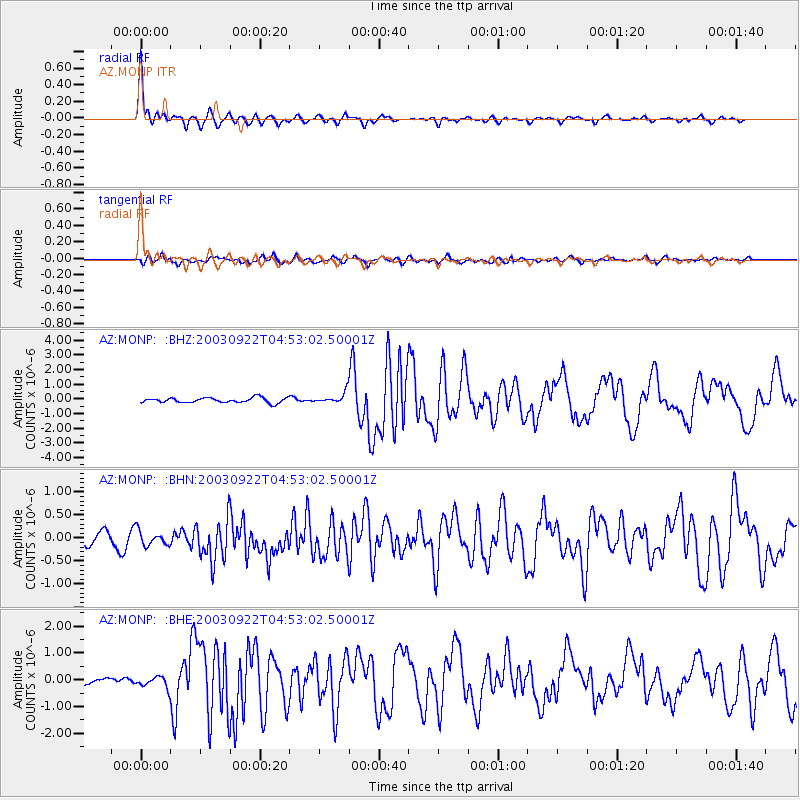
Signal To Noise
| Channel | StoN | STA | LTA |
| AZ:MONP: :BHN:20030922T04:53:02.50001Z | 1.18227 | 1.6586297E-7 | 1.4029195E-7 |
| AZ:MONP: :BHE:20030922T04:53:02.50001Z | 1.7395679 | 2.0496176E-7 | 1.17823376E-7 |
| AZ:MONP: :BHZ:20030922T04:53:02.50001Z | 2.1975057 | 3.7382787E-7 | 1.7011465E-7 |
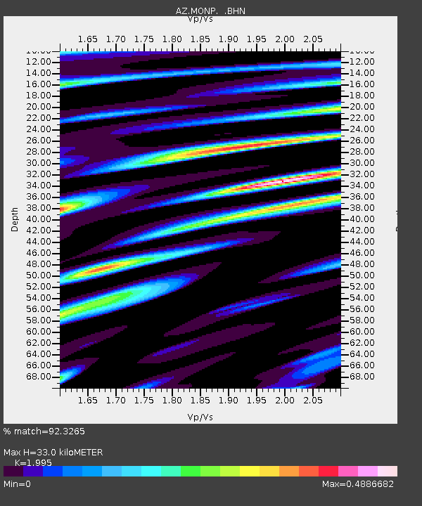
| Arrivals | |
| Ps | 5.5 SECOND |
| PpPs | 15 SECOND |
| PsPs/PpSs | 20 SECOND |

