You are here: Home > Network List > CI - Caltech Regional Seismic Network Stations List
> Station BAR Barrett, Tecate, CA, USA > Earthquake Result Viewer
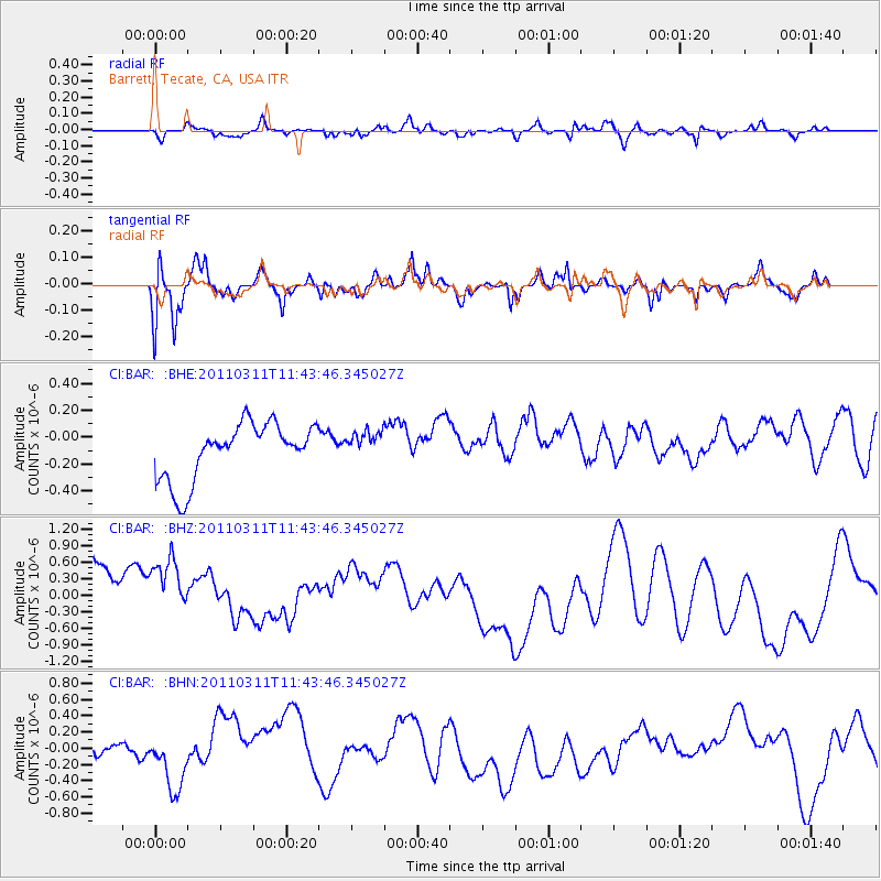
BAR Barrett, Tecate, CA, USA - Earthquake Result Viewer
*The percent match for this event was below the threshold and hence no stack was calculated.
| Earthquake location: |
Off East Coast Of Honshu, Japan |
| Earthquake latitude/longitude: |
39.1/143.2 |
| Earthquake time(UTC): |
2011/03/11 (070) 11:32:27 GMT |
| Earthquake Depth: |
36 km |
| Earthquake Magnitude: |
5.8 MB |
| Earthquake Catalog/Contributor: |
WHDF/NEIC |
|
| Network: |
CI Caltech Regional Seismic Network |
| Station: |
BAR Barrett, Tecate, CA, USA |
| Lat/Lon: |
32.68 N/116.67 W |
| Elevation: |
521 m |
|
| Distance: |
77.2 deg |
| Az: |
58.348 deg |
| Baz: |
308.206 deg |
| Ray Param: |
$rayparam |
*The percent match for this event was below the threshold and hence was not used in the summary stack. |
|
| Radial Match: |
54.344177 % |
| Radial Bump: |
400 |
| Transverse Match: |
69.38495 % |
| Transverse Bump: |
400 |
| SOD ConfigId: |
356183 |
| Insert Time: |
2011-08-15 08:31:14.262 +0000 |
| GWidth: |
2.5 |
| Max Bumps: |
400 |
| Tol: |
0.001 |
|
Signal To Noise
| Channel | StoN | STA | LTA |
| CI:BAR: :BHZ:20110311T11:43:46.345027Z | 1.1465508 | 1.1604474E-6 | 1.0121204E-6 |
| CI:BAR: :BHN:20110311T11:43:46.345027Z | 0.8071696 | 2.8399978E-7 | 3.5184647E-7 |
| CI:BAR: :BHE:20110311T11:43:46.345027Z | 0.5155786 | 1.07600236E-7 | 2.0869803E-7 |
| Arrivals |
| Ps | |
| PpPs | |
| PsPs/PpSs | |


